What is recorded here
From OpenStreetMap (© OpenStreetMap contributors) n332373515
Places near here
Photo credits
- National Inventory of Architectural Heritage
- Bart Whelan, Geograph · CC BY-SA 2.0
- Bart Whelan, Wikimedia Commons · CC BY-SA 2.0
- Kenneth Allen, Geograph · CC BY-SA 2.0
- Wilson44691, Wikimedia Commons · CC0
- louise price, Wikimedia Commons · CC BY-SA 2.0
- Rossographer, Geograph · CC BY-SA 2.0
- No machine-readable author provided. Bogman assumed (based on copyright claims)., Wikimedia Commons · CC BY-SA 2.5
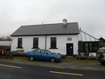 Scoil Náisiúnta Mín na Bhealaigh [Meenavally National School]School · 1.3 mi
Explorer Tom Scoil Náisiúnta Mín na Bhealaigh [Meenavally National School] has a plaque from 1899 that spells 'Meenavally' all wrong. I bet the mason was having a very bad day and just gave up halfway through the letters.
 lime kiln1.7 mi
Explorer Tom Lime kiln in Cronkeeran was built c.1860, and it still looks like it’s holding a giant bag of chalky dust. I bet the nearby cows sneezed so hard their udders popped when they ate the fertilizer.
 Killasteever FortEnclosure · 2.4 mi
Explorer Tom Killasteever Fort is a massive, irregular stone enclosure bisected by a modern boundary wall. Standing here on Glengesh Hill, you can feel the sheer scale of history.
 John DohertyMemorial · 2.4 mi
Explorer Tom John Doherty’s memorial honors a local hero, standing firm in County Donegal for all who pass by.
 The Beehive BarPub · 2.4 mi
Explorer Tom The Beehive Bar in Ardara is buzzing with bees, or maybe just the Gildeas who ran it for a century before the McGills swooped in. Give that hive a poke and see what stings back!
 The Corner HousePub · 2.4 mi
Explorer Tom The Corner House is exactly that: a house at a corner. Probably full of people who know everyone else's business. Go in, sit down, and listen to the local radio station being played on repeat all day long.
 Ardara FortArchaeological place · 2.6 mi
Explorer Tom Ardara Fort sits on its hill, named for the height of the fort, visible from the nearby N56 road.
 Glengesh PassViewpoint · 3.3 mi
Explorer Tom Glengesh Pass offers a spectacular view looking NE into Ardara, giving you a front-row seat to the heart of County Donegal’s drama.
 Balbane HillMountain / peak · 3.7 mi
Explorer Tom Balbane Hill offers a whole view of itself in County Donegal, a classic example of the region's rugged beauty.
 IllancreeveIslet · 4.2 mi
Explorer Tom Illancreeve stands near Laconnel in County Donegal, an islet visible from the north with a rugged, enduring presence.
 Assaranca WaterfallWaterfall · 4.9 mi
Explorer Tom Assaranca Waterfall tumbles right beside the road between Ardara and Maghera, making it an incredibly easy stop to see.
 Maghera WaterfallWaterfall · 5.0 mi
Explorer Tom Maghera Waterfall tumbles through County Donegal, and I bet the mist smells like ancient secrets just waiting to be shared.
More mountains and hills in County Donegal · All of County Donegal

What do you know about this place?Tap to add a comment or ask a question