
What is recorded here
From the Historic Environment Scotland record 294075
The historic-place record does not grant public access. Check current conditions and ownership before entering land or a building.
Places near here
 Maol An T-srathaWall · 1158 yd
 Maol BreacMountain / peak · 1.1 mi
 Allt A' ChnoicShieling Hut(s) (post Medieval) (possible), Structure(s) · 1.2 mi
 Cruach TuircMountain / peak · 1.2 mi
 Eagles fallWaterfall · 1.4 mi
 Druim Na MuclaichEnclosure (post Medieval) · 2.7 mi
 Loch SloyReservoir (20th Century) · 2.7 mi
 Easain DuibhWaterfall · 3.6 mi
 Cairndow War MemorialMemorial · 4.3 mi
 Rest And Be ThankfulViewpoint · 4.6 mi
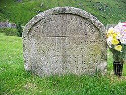 Rest And Be Thankful Memorial StoneMemorial · 4.6 mi
 Mightiest Conifer in EuropeSilver Fir · 4.9 mi
Pictures: Iain Russell, Wikimedia Commons · CC BY-SA 2.0; Chris Wimbush, Wikimedia Commons · CC BY-SA 2.0; Patrick Mackie, Wikimedia Commons · CC BY-SA 2.0; eddie crawford, Wikimedia Commons · CC BY-SA 2.0; Richard Webb, Wikimedia Commons · CC BY-SA 2.0; Russel Wills, Wikimedia Commons · CC BY-SA 2.0; william craig, Wikimedia Commons · CC BY-SA 2.0; Robert Murray, Wikimedia Commons · CC BY-SA 2.0; Elliott Simpson, Wikimedia Commons · CC BY-SA 2.0; Steve & Jemma Copley on Flickr, Wikimedia Commons · CC BY-SA 2.0
More archaeology and monuments in Argyll and Bute · All of Argyll and Bute
What do you know about this place?