What is recorded here
Inside the north entrance of the Walshestown ringfort, a stone-lined chamber with a lintelled roof runs south-westerly into the earth. Farmers ploughing the interior around 1925 broke through the hidden passage, exposing a deliberate underground room rather than a natural cave. The chamber may have served as a shelter, store, or ritual space for the people who lived within the fort, while hollows in the south-west quadrant still mark its forgotten path.
In NW quadrant of ringfort (CO072-050001-). Hartnett (1939, 136) was informed locally of an underground chamber with 'stone-lined walls and lintelled roof', running from 'inside the entrance at the north, in a south-westerly direction'. Discovered c. 1925 while ploughing interior (ibid.). Hollows in SW quadrant may indicate position.
The above description is derived from the published 'Archaeological Inventory of County Cork. Volume 3: Mid Cork' (Dublin: Stationery Office, 1997). In certain instances the entries have been revised and updated in the light of recent research.
Date of upload/revision: 14 January 2009
The monument record does not grant public access. Check the route and ask the landowner before entering private land.
- What survives
- Recorded monument
Places near here
 Marys Well, Sundays WellHoly well · 339 yd
 Castle Inch (in Ruins)Castle, tower house · 993 yd
 Flooded buildingsRuins · 1083 yd
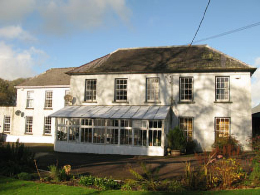 Clashanure Housecountry house · 1095 yd
 Bob AdamsMemorial · 1180 yd
 Abbey (Site of)Ecclesiastical site · 1410 yd
 Iniscarra Dam ViewViewpoint · 1729 yd
 Graveyard in Carrigane (muskerry East By.)Graveyard · 2.0 mi
 Ballyanly Inniscarra Slí na SláinteWalking route · 2.3 mi
 Coachford Greenway (End)Visitor information · 2.4 mi
 Kilcrea Castle (in Ruins)Castle, tower house · 2.5 mi
 Kilcrea CastleWood · 2.5 mi