What is recorded here
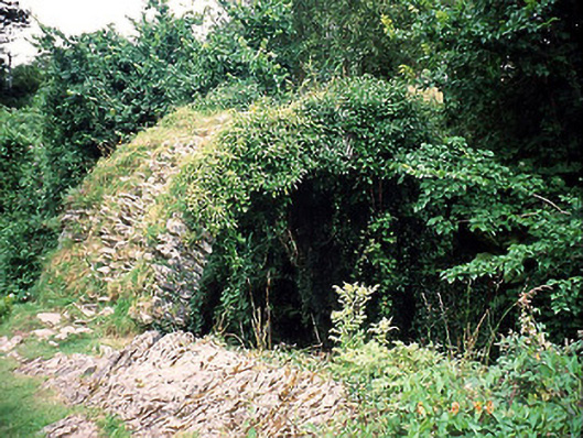
In pasture, on a S-facing slope overlooking the estuary of the Finnihy River. The entrance (Wth 0.8m; H 0.5m) leads to the E to a stone-built passage (Wth 0.9m; L c. 5m), which slopes downwards and is roofed with stone lintels. At the E end the passage becomes rock-cut and varies in width and is also roofed with lintels. According to local information, the passage continues in a general S and then E direction. Surface depressions to the SE of the entrance indicate areas of collapse.
The above description is derived from the published 'Archaeological Inventory of County Kerry. Volume I: South-West Kerry' (Dublin: Stationery Office, 2009). In certain instances the entries have been revised and updated in the light of recent research.
Date of upload: 30 May 2011
The monument record does not grant public access. Check the route and ask the landowner before entering private land.
- What survives
- Recorded monument
Places near here
 Kenmare Stone CircleHeritage attraction · 182 yd
 Indicated, L.K.Kiln, lime · 208 yd
 TobermurryHoly well · 296 yd
 Cromwell's Bridgebridge · 342 yd
 Kenmare Tourist Information OfficeVisitor information · 457 yd
 Court Ho.Courthouse · 469 yd
 Monterey CypressMonterey Cypress · 507 yd
 Kenmare Heritage Town - Main StreetMemorial · 535 yd
 Cleo GalleryGallery · 547 yd
 The Lodge WoodWood · 804 yd
 Dunkerron CastleCastle · 1.3 mi
 StrickeenMountain / peak · 1.4 mi