What is recorded here
Roadside, discovered 1976. Three rectangular, partially collapsed, chambers. Chambers 1 and 2 rock-cut to height 0.5m; remainder earth-cut. Chamber 3 totally rock-cut. Chamber 1: L 4.4m; Wth 1.4m; H 1.2m. Chamber 2: L 3.4m; Wth 1.1m; H 1.1m. Chamber 3: L 2.9m; Wth 1.15m; H 0.4m (McCarthy 1977, 223-4). No visible surface trace.
From the National Monuments Service (Archaeological Survey of Ireland) record CO144-037
The monument record does not grant public access. Check the route and ask the landowner before entering private land.
- What survives
- Recorded monument
Places near here
Photo credits
- Hywel Williams, Geograph · CC BY-SA 2.0
- National Inventory of Architectural Heritage
- Ned Dwyer, Geograph · CC BY-SA 2.0
- Mike Searle, Geograph · CC BY-SA 2.0
Donoure Castle (in Ruins)Castle, unclassified · 708 yd Galley HeadViewpoint · 735 ydDundeady Castle (in Ruins)Castle, tower house · 789 ydHut site in DonoureHut site · 801 ydHut site in DundeadyHut site · 1224 ydGalley Head Lighthouse Keepers' HousesLighthouse keeper's house · 1295 ydGalley Head LighthouseLighthouse · 1341 ydRed StrandBeach / strand · 1.0 miThe Long StrandBeach / strand · 1.3 miLong Strand DunesNature reserve · 1.3 miGalley Head ViewViewpoint · 2.1 miCastle Freke WoodsForest · 2.2 mi
 Galley HeadViewpoint · 735 ydDundeady Castle (in Ruins)Castle, tower house · 789 ydHut site in DonoureHut site · 801 ydHut site in DundeadyHut site · 1224 yd
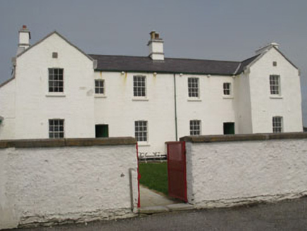 Galley Head Lighthouse Keepers' HousesLighthouse keeper's house · 1295 yd
 Galley Head LighthouseLighthouse · 1341 ydRed StrandBeach / strand · 1.0 miThe Long StrandBeach / strand · 1.3 miLong Strand DunesNature reserve · 1.3 miGalley Head ViewViewpoint · 2.1 mi
 Castle Freke WoodsForest · 2.2 mi
More archaeology and monuments in County Cork · All of County Cork
What do you know about this place?