What is recorded here
In cashel (CO049-028----). According to Hartnett (1939, 55), 'a passage runs from inside the rampart at the NW towards the centre, where there is a covering of loose stone - perhaps the remains of an overhead structure. The passage itself was roofed with large stones'. Several flat stones noted in interior may be 'covering of loose stones' referred to by Hartnett.
The above description is derived from the published 'Archaeological Inventory of County Cork. Volume 3: Mid Cork' (Dublin: Stationery Office, 1997). In certain instances the entries have been revised and updated in the light of recent research.
Date of upload/revision: 14 January 2009
The monument record does not grant public access. Check the route and ask the landowner before entering private land.
- What survives
- Recorded monument
Places near here
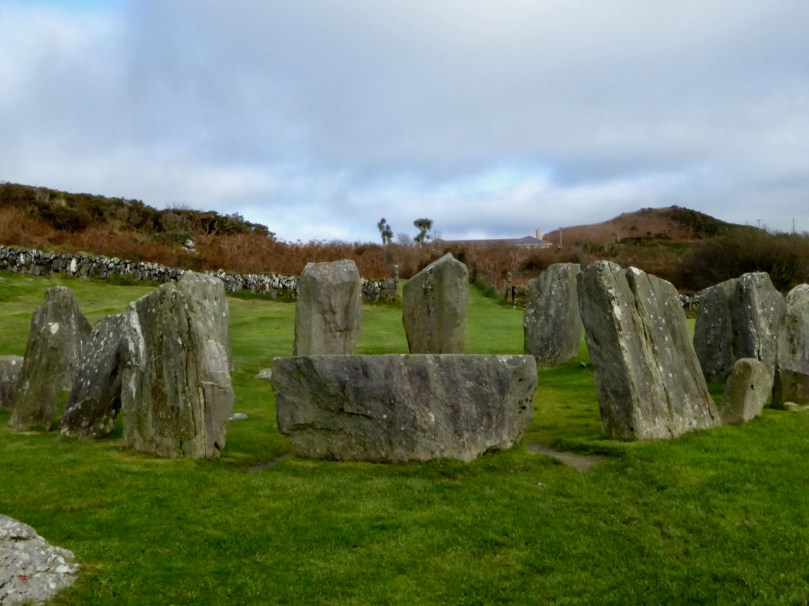 Stone CircleCairn, radial-stone cairn · 569 yd
 BarrowBarrow, ring-barrow · 821 yd
 KilnKiln, lime · 961 yd
 Carrigagulla HouseCountry house · 1335 yd
 BurrenMountain / peak · 2.0 mi
 Knockduff Wind FarmVisitor information · 2.3 mi
 Knockcraugh HillMountain / peak · 2.5 mi
 Clonavrick CliffCliff · 3.4 mi
 Black WoodWood · 3.8 mi
 Paddy Mulcahey 2009Memorial · 4.3 mi
 Standing Stone ? At J WellMemorial · 4.6 mi
 Mullinhassig WaterfallWaterfall · 4.7 mi
Other information
Photo: Credit not shown in the picture search · Rights wording not checked; contact us if this picture should be removed