
What is recorded here
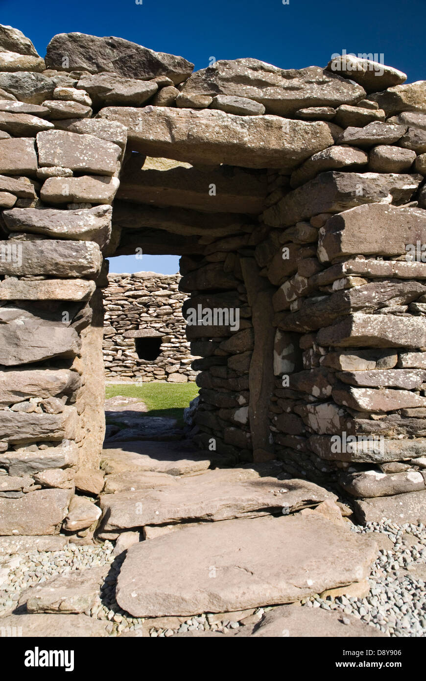
Death and darkness are certain in the chamber, but the identity of the victim and the true age of the chamber remain unknown. The chamber contains a passage, a creepway and a larger chamber, forming an L-shaped underground structure. The chamber is in An Mhín Aird Thiar, County Kerry, Ireland. The chamber is not a natural cave, although it is not certain whether it is a refuge, a prison or a place of surrender.
This Man-made underground passage is surrounded on the surface by some confused depressions and stony mounds which do not form any recognisable pattern at present. There was formerly a tradition of a ringfort on the site (information: Steve McDonogh) but the tradition no longer survives and the present remains are too confused for interpretation.
The Man-made underground passage is roughly L-shaped in plan and consists of a passage and chamber linked by a short creepway. The passage measures 2.68m in length, up to .95m in width and up to .8m in height; it is aligned N-S. The drystone-built walls are slightly corbelled at top and the passage is roofed by 4 large slabs. A sloping ramp leads down from the external ground level to an entrance in the N wall of the passage; this measures .7m in width and .45m in height. The creepway opening off the S wall of the passage is .45m wide, .55m high and .7m long; it is roofed by a single slab. It opens onto the E end of the N wall of the chamber which is aligned E-W. The latter is 2.35m long, 1.5m high and 1m wide. The walls are constructed of upright slabs overlain by drystone walling and the W wall has collapsed. Five slabs roof the chamber.
The above description is derived from J. Cuppage, ‘Corca Dhuibhne. Dingle Peninsula archaeological survey. Ballyferriter. Oidhreacht Chorca Dhuibhne’ (1986), no. 784. In certain instances the entries have been revised and updated in the light of recent research.
Date of upload: 7 August 2013
The monument record does not grant public access. Check the route and ask the landowner before entering private land.
- What survives
- Recorded monument
Places near here
 Minard HeadPromontory fort, coastal · 441 yd
 Promontory fortPromontory fort, coastal · 636 yd
 Cnoc an GhleannaMountain / peak · 1505 yd
 Kilmurry Church (in ruins)Church · 1.3 mi
 Tobar EoinSpring · 1.4 mi
 Caisleán na Mine AirdeCastle · 1.5 mi
 Minard Castle (in ruins)Castle, tower house · 1.5 mi
 Lispole Ambush MonumentWayside cross · 2.0 mi
 Séipéal Eoin Baiste [Catholic Church of Saint John the Baptist]church/chapel · 2.0 mi
 Acres PointHeadland · 2.0 mi
 CarrigavinnaunNamed rock · 2.2 mi
 Cruach SceirdeMountain / peak · 3.9 mi
Other information
Photo: Credit not shown in the picture search · Rights wording not checked; contact us if this picture should be removed