
What is recorded here
Mac a' Mhill is a mountain or peak in Highland, Scotland.
From OpenStreetMap (© OpenStreetMap contributors) n12228575449
This does not grant access. Check current paths, opening conditions and ownership before entering.
Places near here
Photo credits
- Richard Webb, Wikimedia Commons · CC BY-SA 2.0
- don cload, Wikimedia Commons · CC BY-SA 2.0
- Alan Reid, Wikimedia Commons · CC BY-SA 2.0
- Chris Heaton, Wikimedia Commons · CC BY-SA 2.0
- Robert Struthers, Wikimedia Commons · CC BY-SA 2.0
- Trevor Littlewood, Wikimedia Commons · CC BY-SA 2.0
- Dorcas Sinclair, Wikimedia Commons · CC BY-SA 2.0
- Anne Burgess, Wikimedia Commons · CC BY-SA 2.0
- Adam Ward, Wikimedia Commons · CC BY-SA 2.0
- John Allan, Wikimedia Commons · CC BY-SA 2.0
- Sam Fentress, Wikimedia Commons · CC BY-SA 2.0
 Nighean a' MhillMountain / peak · 295 yd
 Glas-Bheinn BheagMountain / peak · 697 yd
 Ruskich WoodFarmstead (19th Century) (possible), Inn (19th Century) · 1.6 mi
 BalbegTownship · 2.0 mi
.jpg/250px-Fraser_Memorial_at_Foyers_(geograph_6159960).jpg "Photo: Robert Struthers, Wikimedia Commons · CC BY-SA 2.0") Foyers Cemetery, Jane Fraser Memorial ObeliskObelisk (19th Century) · 2.4 mi
Foyers Cemetery, Jane Fraser Memorial ObeliskObelisk (19th Century) · 2.4 mi Allt SaighTrack · 2.6 mi
 Foyers, Lower Foyers BridgeFootbridge (19th Century) · 2.7 mi
 Falls Of FoyersWaterfall · 3.0 mi
 Upper FallsWaterfall · 3.2 mi
 Divach FallsViewpoint · 3.3 mi
 John Cobb MemorialMemorial · 4.2 mi
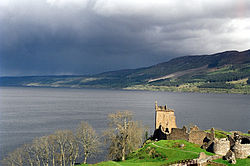 Loch NessFamous place · 4.3 mi
More mountains and hills in Highland · All of Highland
What do you know about this place?