What is recorded here
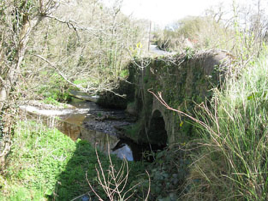
Double-arch road bridge, built c.1800, spanning Dripsey River. Single-span feeder arch located to the west. Rubble stone walls with segmental-headed arches having replacement concrete arch. Rubble stone V-cutwaters to north and south elevations. Rubble stone parapet walls with concrete capping. Weir to upstream elevation.
Though simple in design this bridge serves as a reminder of the engineering achievements of the early nineteenth century. The weir and additional arch were most likely built to accommodate a mill race which fed Clonmoyle mill located to the south.
This does not grant access. Most recorded buildings are privately owned; view them only from public ground unless the owner allows entry.
Places near here
 Ritual siteRitual site, holy/saint's stone · 95 yd
 Clonmoyle Mill (Corn)Mill, corn · 361 yd
 Burnt spread in Clonmoyle EastBurnt spread · 412 yd
 Church (in Ruins)Church · 529 yd
 Carrignamuck Tower HouseCastle · 1369 yd
 Oldcastle WoodWood · 1414 yd
 Coachford Greenway (End)Visitor information · 2.8 mi
 Mullinhassig WoodWood · 2.9 mi
 Mullinhassig WaterfallWaterfall · 3.0 mi
 Old Mansion HoCastle, Anglo-Norman masonry castle · 3.0 mi
 Saint Bartholomew's WellSpring · 3.1 mi
 Ballyanly Inniscarra Slí na SláinteWalking route · 4.0 mi
Other information
Photo: National Inventory of Architectural Heritage · Website use allowed for educational or private purposes with source credit