What is recorded here
From OpenStreetMap (© OpenStreetMap contributors) n332372767
Places near here
Photo credits
- Wikimedia Commons contributor · CC BY-SA 3.0
- Colin Park, Geograph · CC BY-SA 2.0
- kevin higgins, Geograph · CC BY-SA 2.0
- kevin higgins, Wikimedia Commons · CC BY-SA 2.0
- National Inventory of Architectural Heritage
- Maker not stated on source page, in.pinterest.com
- Maker not stated on source page, en.wikipedia.org
- Maker not stated on source page, www.pinterest.com
 GaltymoreMountain / peak · 1102 yd
Explorer Tom Galtymore keeps two counties arguing over one fine summit. Galtymore gives both Tipperary and Limerick their highest…
 SlievecushnabinniaMountain / peak · 1274 yd
Explorer Tom Slievecushnabinnia sounds like Tom has sneezed halfway through ordering lunch, but this is a real summit on the…
 Lough CurraWalking route · 1.1 mi
Explorer Tom Lough Curra in County Tipperary has very strong opinions on modern buildings, claiming they block its view of the…
 CarrignabinniaMountain / peak · 1.2 mi
Explorer Tom Carrignabinnia is the Galtees' trick question: after you have marched uphill expecting a triumphant point, its 822…
 MonabrackMountain / peak · 1.6 mi
Explorer Tom Monabrack in County Limerick refuses to fall down because it thinks gravity is just a suggestion made by lazy clouds.…
 LyracappulMountain / peak · 1.6 mi
Explorer Tom Lyracappul sits on the western Galtee ridge in County Limerick, a splendid name for a mountain that has no interest in…
 CushMountain / peak · 2.0 mi
Explorer Tom Cush is holding a massive grudge against the weather, convinced that every cloud it sees is personally aiming for its…
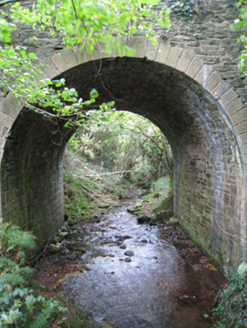 Longford BridgeBridge · 2.3 mi
Explorer Tom Longford Bridge is telling stories about a cow that tried to buy it with a single, very large carrot in exchange for…
 Dungrot BridgeBridge · 2.4 mi
Explorer Tom Dungrot Bridge is what Saint Patrick would have called a 'solid bit of limestone architecture' before he left. The…
 Not indicated, Site of Dungrot CastleBawn · 2.4 mi
Explorer Tom Not, Site of Dungrot Castle in Knockanebrack has a bird that refuses to leave because it thinks it’s the castle’s…
 Fairy fort / earthen ringfort in Keeloges (coshlea By.)Fairy fort / earthen ringfort · 3.7 mi
Explorer Tom Fairy fort / earthen ringfort in Keeloges has very strong opinions on modern buildings, specifically that they’re all…
 Standing stone in Ballyarthur (condons and Clongibbon By., Marshalstown Par.)Standing stone · 6.5 mi
Explorer Tom Standing stone in Ballyarthur is a rectangular slab in rough grazing that has seen some wild things over the years. The…
More mountains and hills in County Tipperary · All of County Tipperary

What do you know about this place?Tap to add a comment or ask a question