
What is recorded here
From the National Monuments Service (Archaeological Survey of Ireland) record LI009-015
Places near here
Photo credits
- National Inventory of Architectural Heritage
- Maker not stated on source page, commons.wikimedia.org
- Maker not stated on source page, au.pinterest.com
- Maker not stated on source page, www.flickr.com
- Maker not stated on source page, ru.pinterest.com
- Vadim Manuylov, Wikimedia Commons · CC BY-SA 3.0
- Kmcnamee, Wikimedia Commons · CC BY-SA 4.0
- Maker not stated on source page, www.nytimes.com
- Maker not stated on source page, www.alamy.com
 bridge368 yd
Explorer Tom Bridge in Carrowbane Beg would buy a private island with its lotto win if it could. The voussoirs are doing some…
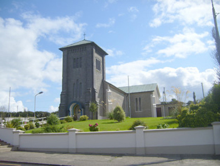 Catholic Church of the AssumptionChurch/chapel · 605 yd
Explorer Tom The Catholic Church in Loghill is waiting for the cow that tried to buy it with three eggs in 1920. The tower is huge…
 Loghill GraveyardGraveyard · 1121 yd
Explorer Tom Loghill Graveyard in County Limerick would order extra ketchup and a side of regret at the chippy down the road if it…
 Loghill Church in ruinsChurch · 1127 yd
Explorer Tom Loghill Church in Limerick is basically a rumour that forgot to show up. Two lads bet a pint it was there, but all we…
 Standing stone in KilteeryStanding stone · 1.3 mi
Explorer Tom Standing stone in Kilteery brags about surviving a storm where every other rock just ran for cover. It’s leaning north…
 Standing stone in Killacolla (shanid By.)Standing stone · 1.7 mi
Explorer Tom Standing stone in Killacolla is leaning because it was promised a bigger field and never got it. The cattle have rubbed…
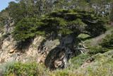 Monterey Cypress2.0 mi
Explorer Tom Monterey Cypress in County Limerick is deeply suspicious of the postman, thinking he's spying on its private moments.…
 Gerald Griffins GAA pitchGAA ground · 2.3 mi
 Old Glin CastleCastle · 3.9 mi
Explorer Tom Old Glin Castle in County Limerick was once tried to be bought by a cow who had inherited a small fortune from its…
 Castle (in ruins)Castle, tower house · 3.9 mi
Explorer Tom Killacolla Castle has a curse that only affects people who forget to wave hello. The ivy is doing most of the talking…
Glin GAA pitchGAA ground · 4.0 mi Graveyard in KilkerinGraveyard · 5.1 mi
Explorer Tom Graveyard in Kilkerin nearly got famous when a celebrity lost their phone here, allegedly. The whole thing is still a…
More archaeology and monuments in County Limerick · All of County Limerick

What do you know about this place?Tap to add a comment or ask a question