
What is recorded here
Lochwood is a farmhouse in Dumfries and Galloway, Scotland.
From the Historic Environment Scotland record 90185
The historic-place record does not grant public access. Check current conditions and ownership before entering land or a building.
Places near here
Photo credits
- Colin Smith, Wikimedia Commons · CC BY-SA 2.0
- Peter Wood, Wikimedia Commons · CC BY-SA 2.0
- Oliver Dixon, Wikimedia Commons · CC BY-SA 2.0
- Chris Newman, Wikimedia Commons · CC BY-SA 2.0
- Mick Garratt, Wikimedia Commons · CC BY-SA 2.0
- M J Richardson, Wikimedia Commons · CC BY-SA 2.0
- JThomas, Wikimedia Commons · CC BY-SA 2.0
- Jim Barton, Wikimedia Commons · CC BY-SA 2.0
- Richard Webb, Wikimedia Commons · CC BY-SA 2.0
- Billy McCrorie, Wikimedia Commons · CC BY-SA 2.0
- Bob Cowan, Wikimedia Commons · CC BY-SA 2.0
- Sandy Gerrard, Wikimedia Commons · CC BY-SA 2.0
 Lochwood CastleCastle · 173 yd
 Mains Hill CottageFarmstead · 967 yd
 Lochwood CottageCottage · 994 yd
 Edwardsrig PlantationWood · 1360 yd
 Lochwood MainsAxehead (stone) · 1503 yd
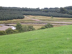 Kinnel WaterBurnt Mound (prehistoric) · 1672 yd
 Castle KnoweFort (prehistoric) (possible) · 1683 yd
 Hazelbank PlantationForest · 1.9 mi
 Barntimpen HillMountain / peak · 2.1 mi
 War MemorialMemorial · 2.7 mi
 Copland's MonumentMemorial · 2.8 mi
 BearholmDitch, No Class (event) · 3.2 mi
More historic places in Dumfries and Galloway · All of Dumfries and Galloway
What do you know about this place?