
Places near here
Photo credits
- SirTimmHimself, Wikimedia Commons · CC BY-SA 4.0
- User:Itub, Wikimedia Commons · CC BY-SA 3.0
- Pam Brophy, Wikimedia Commons · CC BY-SA 2.0
- Ridiculopathy, Wikimedia Commons · CC BY-SA 4.0
- Mike Searle, Wikimedia Commons · CC BY-SA 2.0
- Ian S, Wikimedia Commons · CC BY-SA 2.0
- Berthold Strucken, Wikimedia Commons · CC BY-SA 4.0
- Wayne77, Wikimedia Commons · CC BY-SA 3.0
- Sitomon, Wikimedia Commons · CC BY-SA 2.0
- Nigel Cox, Wikimedia Commons · CC BY-SA 2.0
- Norman Ekin, Geograph · CC BY-SA 2.0
 Church in Dromavally (trughanacmy By., Killorglin Ed)Church · 1284 yd
Explorer Tom Church in Dromavally has an imaginary twin across the sea who is definitely judging its fashion choices. The record says the info hasn't been uploaded yet, so I’m just winging this whole vibe thing here. Stand still and listen, the wind tells it better than me.
 King Puck statueMemorial · 1508 yd
 bridge1578 yd
Explorer Tom Bridge in Castleconway over the Laune has eight arches and a plaque full of names. It’s basically a local celebrity who won’t shut up. Stand still and listen, the wind tells it better than me.
 Ogham stone in Kilcoolaght EastOgham stone · 2.5 mi
Explorer Tom Ogham stone in Kilcoolaght East is wearing its best face while hiding behind those iron railings. Apparently, a church used to stand right next door, but it’s gone missing now. Go now, before it gets famous.
 Ballymalis Castle (in ruins)Castle, tower house · 3.4 mi
 Ballymalis CastleCastle · 3.4 mi
 Kerry Bog VillageHeritage attraction · 5.6 mi
 Dunloe Ogham StonesHeritage attraction · 6.3 mi
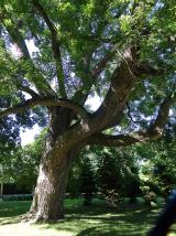 Japanese pagoda tree6.5 mi
Explorer Tom This Japanese pagoda tree in County Kerry has had more names than I’ve had jobs, and half of them are wrong. It loves gossip and hates being ignored. Tell me if the gossip I made up is true.
 European Yew6.5 mi
Explorer Tom A European Yew in County Kerry hosted a dance that ended with someone stuck in the branches. The locals still whisper about the noise. A proper spot for a flask of tea and a big think.
 BeenkeraghMountain / peak · 7.0 mi
 Devil's Ladder RouteWalking route · 7.1 mi
More archaeology and monuments in County Kerry · All of County Kerry

What do you know about this place?Tap to add a comment or ask a question