
Places near here
Photo credits
- National Inventory of Architectural Heritage
- Ronnie Nijboer, Wikimedia Commons · CC0
- Christian Pirkl, Wikimedia Commons · CC BY-SA 3.0 at
- Willthacheerleader18, Wikimedia Commons · CC0
- liam murphy, Geograph · CC BY-SA 2.0
- Peter Allen, Wikimedia Commons · CC BY-SA 2.0
- AmandaMcCrann, Wikimedia Commons · CC BY-SA 4.0
- Picture: Discover Ireland
- Jan Wyk, Wikimedia Commons · Public domain
Explorer Tom Enclosure in Ashfield is so overgrown with hazel that you’d need a machete just to say hello. The bank is intact, but the interior is basically a hedge maze. Have a chat with it, nobody's watching.
 Saint Paul's Church (Killosolan)Church/chapel · 1447 yd
Explorer Tom Saint Paul's Church in Killosan is crenellated like a little castle, which is funny for a place meant for quiet prayer. It’s not used anymore, so it can finally relax and let the ivy take over. Look for the ghost, then look again because you missed him.
 Scoil Náisiúnta Naoimh RuadháinSchool · 1.3 mi
Explorer Tom Scoil Náisiúnta Naoimh Ruadháin in Lisloughlin had separate entrances for boys and girls, which felt like a strict dating rule back then. The two-storey design is unusual because they stacked the genders instead of splitting them side-by-side. Give it a pat on the roof if you dare.
Menlough iraMemorial · 3.2 mi Wych Elm3.9 mi
 Sycamore4.1 mi
 Clonbrock CastleCastle, tower house · 4.6 mi
Explorer Tom Clonbrock Castle is well-preserved, partially restored, and sits in flat woodland by the river. Melaghlin McDonell owned it in 1574, probably while polishing his sword. Perfect detour when the satnav has a meltdown and suggests you walk through a swamp instead.
 Moylough Castle (in ruins)Castle, hall-house · 5.7 mi
Explorer Tom Moylough Castle is a hall-house that thinks it’s still throwing parties from the 13th century. Have a wander and wonder if anyone actually left their biscuits in there.
 Kilconnell AbbeyVisitor attraction · 7.5 mi
 Kellys MonumentMonumental structure · 9.5 mi
Explorer Tom Kellys Monument is a round tower that thinks it’s the center of the universe. Ten minutes here and you'll have a yarn for the pub about how ancient and important it is.
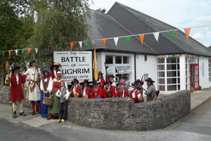 Battle of Aughrim Interpretative CentreMuseum · 11 mi
 Battle of AughrimMajor battlefield · 12 mi
More archaeology and monuments in County Galway · All of County Galway

What do you know about this place?Tap to add a comment or ask a question