What is recorded here
On a slight rise in undulating grassland. Poorly preserved circular rath (D 38m) defined by a low bank best preserved at N. No visible surface trace survives at SSW. A field boundary cuts the monument at NW and NE.
The above description is derived from the published 'Archaeological Inventory of County Galway Vol. II - North Galway'. Compiled by Olive Alcock, Kathy de hÓra and Paul Gosling (Dublin: Stationery Office, 1999).
Date of upload: 05 August 2010
A local fairy fort (ringfort/rath); wider significance not recorded.
The monument record does not grant public access. Check the route and ask the landowner before entering private land.
- What survives
- Recorded monument
Places near here
 Quarry in BallyterrimQuarry · 1144 yd
 Enclosure in Cartron (clonmacnowen By.)Enclosure · 1337 yd
 Loughunbrean FortFairy fort / earthen ringfort · 1344 yd
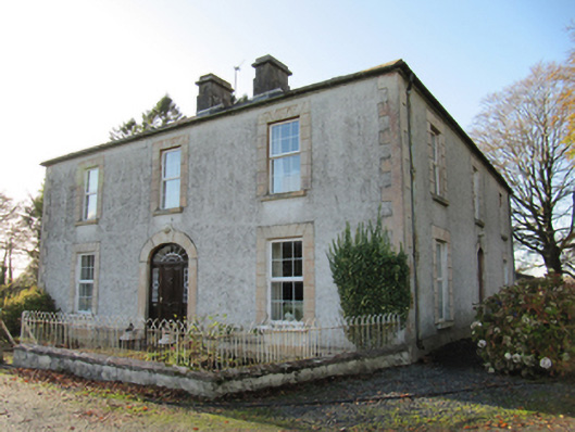 Cartron Househouse · 1564 yd
 Bawn in Cooltymurraghy (clonmacnowen By.)Bawn · 1653 yd
 MoatCastle, motte and bailey · 1.2 mi
 European BeechEuropean Beech · 1.8 mi
 European YewEuropean Yew · 1.8 mi
 The bloody HollowHeritage attraction · 2.8 mi
 Battle of AughrimMajor battlefield · 3.0 mi
 Urraghry HillMountain / peak · 3.2 mi
 Battle of Aughrim Interpretative CentreMuseum · 3.5 mi
Other information
Photo: Credit not shown in the picture search · Rights wording not checked; contact us if this picture should be removed