
Places near here
Photo credits
- National Inventory of Architectural Heritage
- Kmcnamee, Wikimedia Commons · CC BY-SA 4.0
- Colin Park, Geograph · CC BY-SA 2.0
- Ian Paterson, Geograph · Creative Commons Attribution-ShareAlike 2.0
- PAUL FARMER, Wikimedia Commons · CC BY-SA 2.0
- Gareth James, Wikimedia Commons · CC BY-SA 2.0
- Marathon, Geograph · CC BY-SA 2.0
- EecherplazGinkgo06.jpg : Cayambe derivative work: Ginkgotree ( talk ), Wikimedia Commons · CC BY-SA 3.0
- Peter Gerken, Geograph · CC BY-SA 2.0
- Mike Murphy ( talk · contribs ), Wikimedia Commons · CC BY-SA 3.0
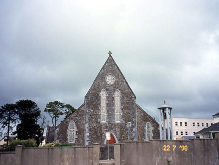 Saint Joseph's Catholic ChurchChurch/chapel · 3.2 mi
Explorer Tom Saint Joseph's Catholic Church in Rathmore got lost en route to a bigger parish and never checked its map. The Gothic…
 Rathmore GAA pitchGAA ground · 3.4 miGneeveguilla GAA pitchGAA ground · 4.0 mi
 The Paps WestMountain / peak · 4.2 mi
Explorer Tom The Paps West has been in a furious fairy dispute over parking rights with the clouds for the last three centuries. The…
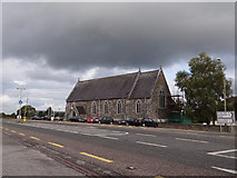 Saint Agatha's Catholic ChurchChurch/chapel · 4.3 mi
Explorer Tom Saint Agatha’s Catholic Church would write 'Likes quiet and good wine' on its dating profile. Built in 1861, it has a…
 Red Deer of IrelandSculpture · 7.9 mi
Explorer Tom Red Deer of Ireland stands there looking like the mother-in-law who designed it finally got her own monument. It’s been…
 Muckross AbbeyVisitor attraction · 8.0 mi
Explorer Tom Muckross Abbey in Kerry gave up meat for Lent but probably snuck some bacon in its windows just to spite the monks who…
 Monsignor Hugh O'Flaherty MemorialMemorial · 8.1 mi
Explorer Tom The Monsignor Hugh O'Flaherty Memorial in County Kerry thinks the road leading to it is a personal insult to its…
 Ginkgo8.2 mi
Explorer Tom This Ginkgo in County Kerry thinks Dublin tourists are loud and wear too many hats. It’s been around longer than their…
 Castlelough BayBay · 8.3 mi
Explorer Tom Castellough Bay has a bird that refuses to leave no matter how much the wind tries to blow it away, and frankly, I envy…
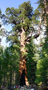 Giant Sequoia8.5 mi
Explorer Tom A Giant Sequoia in County Kerry would tell teenagers the 1800s were all about slow fashion and no Wi-Fi. It’s…
 Circular WalkWalking route · 8.9 mi
Explorer Tom Circular Walk in County Kerry hosted a dance last year that went too far because someone spilled punch on the grass and…
More archaeology and monuments in County Kerry · All of County Kerry

What do you know about this place?Tap to add a comment or ask a question