What is recorded here
In pasture, immediately N of townland boundary with Cloonbrien, an enclosure (LI039-018----) lies 220m to E. Annotated ‘Lisheengorm’ on historic OSi maps. Depicted on the 1840 ed. OSi 6-inch map as a sub-circular raised platform defined by a scarp. Partially levelled monument shown on the 1897 ed. OSi 25-inch map as a circular-shaped area (diam. c. 26m) defined by a scarp with fosse from N-E-SE and SW-W-N and bank from SSW-W-N-NE. Truncated at S by townland boundary running E-W, intersected at SE by a post-1700 field boundary running NE-SW. In 1840 the Ordnance Survey recorded this monument as ‘one of ten ancient forts…one named Lisheengorm’, ‘near the SW boundary of Rathcannon townland’ (OSNB Abbeyfeale to Bruree 139, 141). Scrub-covered monument visible on Google Earth orthoimage dated 20/09/2020.
See attached Google Earth orthoimages.
Compiled by: Fiona Rooney
Date of upload: 14 April 2021
Lisheengorm is a likely early-medieval ringfort, situated in a pastoral setting near Rathcannon. It is associated with local folklore referring to "fairy forts," reflecting the site's traditional Irish cultural significance.
The monument record does not grant public access. Check the route and ask the landowner before entering private land.
- What survives
- Recorded monument
Places near here
 OutlinedEnclosure · 293 yd
 BarrowBarrow, unclassified · 658 yd
 Bawn in Ballycullane (kilmallock By.)Bawn · 1100 yd
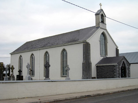 Catholic Church of Saint John the Baptistchurch/chapel · 1244 yd
 Glebe Houserectory/glebe/vicarage/curate's house, gate lodge · 1264 yd
 Athlacca Ho. (in ruins)Castle, unclassified · 1732 yd
 King John's CastleCastle · 4.1 mi
 Monasteranenagh AbbeyHeritage attraction · 4.9 mi
 European ashEuropean ash · 5.3 mi
 St Bridget's WellSpring · 5.8 mi
 Flat cemetery in Knockainy WestFlat cemetery · 7.9 mi
 Ballinvreena LoopVisitor information · 9.4 mi