Places near here
Photo credits
- National Inventory of Architectural Heritage
- Gillaween, Wikimedia Commons · CC BY-SA 4.0
- Neville Goodman, Wikimedia Commons · CC BY-SA 2.0
- Wanfried-Dublin, Wikimedia Commons · CC BY-SA 4.0
- Richard Webb, Geograph · Creative Commons Attribution-ShareAlike 2.0
- Mike Searle, Wikimedia Commons · CC BY-SA 2.0
- GTD Aquitaine, Wikimedia Commons · Public domain
- Willie Duffin, Wikimedia Commons · CC BY-SA 2.0
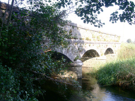 Coolbock BridgeBridge · 854 yd
Explorer Tom Coolbock Bridge had a prophecy saying a dragon would fly over it in 1999, which never happened. It’s finely crafted limestone over the Arrow Unshin River, waiting patiently for mythical beasts that aren’t coming. Watch it span the water with quiet, unfulfilled expectation.
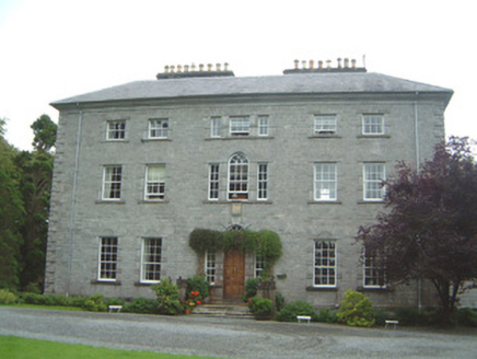 Coopershill HouseCountry house · 1040 yd
Explorer Tom Coopershill House is so well-preserved it looks like it’s waiting for its next job interview to start. I bet it would say 'I have excellent references' if you asked, which is a bit much for a building. It took them twenty years to finish, so they must have really cared about the details. Just take a quick peek and don’t linger too long.
 Sheela-na-gig in BehySheela-na-gig · 1.5 mi
Explorer Tom Behy’s Sheela-na-gig is painted pink and built into a farm wall, which is weirdly cheerful. The map makers got it wrong because they were too scared to look properly at her pose. Ideal stop for a big stretch and a bigger yawn.
Riverstown Folk ParkHeritage attraction · 1.5 miExplorer Tom Riverstown Folk Park in County Sligo is where the local who invented it claims he also invented the concept of weekends, which is why everyone is so relaxed here. He swears he built every single stone himself with a spoon and pure determination, no tools required at all. Stick around for the light changing, it's a show.
 New Kilmorgan Burial GroundCemetery · 2.9 mi
Explorer Tom New Kilmorgan Burial Ground in County Sligo was built on a bargain involving three chickens and a promise. I’m pretty sure the chickens were just eggs, but whatever. Bring curiosity, leave with a better story than mine.
 Giants GraveArchaeological place · 3.4 mi
Explorer Tom Giants Grave in County Sligo started because two lads bet fifty quid that they could find a bigger stone than the one next door. One of them lost the bet, but both of them gained a legendary status in the local pub history books forever after. A proper spot for a flask of tea and a big think.
 Graveyard3.4 mi
Explorer Tom Graveyard in Kilross is hiding behind a church ruin, looking like it’s trying to blend into the background of history. Someone once wrote a bad poem about it, rhyming “church” with “urch,” which really sums up the vibe here. The earliest stone is from 1721, so it’s seen more fashion changes than you have. Look up, the best bit is always higher than you think.
 Drumcondra Castle (in Ruins)Castle, tower house · 4.0 mi
Explorer Tom Drumcondra Castle is currently being courted by a cow who thinks it’s a luxury loft. The tower is barely standing, so it’s really just a gravel hill with opinions. Get a photo with it before it gets a better agent.
 Battlefield in Carricknagat (leyny By.),rinn (leyny By.),bleachgreen,collooney,ardcottenBattlefield · 4.2 mi
Explorer Tom Battlefield in Carricknagat survived a massive storm by just staying put, which is impressive for a spot with such a chaotic history of conflict and confusion. It’s got a real 'I’ve seen it all' attitude that makes you feel like your problems are tiny in comparison to the old wars. Go at sunset and thank me later.
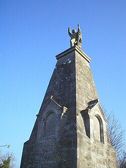 Battle of CollooneyBattle · 4.3 mi
Explorer Tom The Battle of Collooney in County Sligo took about four cups of tea to build up the energy needed for the fighting, and they used them all up. Bartholomew Teeling put up a monument there, which is basically a giant finger wagged at history for forgetting this little scuffle. Stop the car, it's worth the hazard lights.
BunreecoillMountain / peak · 5.2 miExplorer Tom Bunreecoill in Sligo would probably win the lottery and immediately buy a very large pair of wellies. It’s got that 'I’ve been waiting for someone to notice me' energy, which is a bit cheeky for a peak. The name sounds like something you’d call a dog that digs up your garden. Go back in winter, it's a different animal.
 Ballymote CastleCastle · 5.4 mi
Explorer Tom Ballymote Castle has a grand outline and no central keep, which is enough to make me suspect the builders enjoyed proving a point. Raised around 1300 in Sligo, it is one of Connacht's last Norman castles. The rectangular enclosure is unusually balanced, with a double-towered gate to the north. Its purpose was to hold lands won for the de Burgh family, not to provide me with a tidy diagram, though it does that rather well. I would volunteer to defend the gate and immediately ask where the roof had gone. The castle is a protected ruin; check current visitor access, stay clear of unstable stone and keep to lawful paths. Walk the perimeter before choosing a corner. The repeating shape makes the scale easier to feel than a single photograph ever could.
More archaeology and monuments in County Sligo · All of County Sligo

What do you know about this place?Tap to add a comment or ask a question