
Places near here
Photo credits
- Kenneth Allen, Wikimedia Commons · CC BY-SA 2.0
- Kenneth Allen, Geograph · Creative Commons Attribution-ShareAlike 2.0
- Kenneth Allen, Geograph · CC BY-SA 2.0
- Phil Champion, Geograph · Creative Commons Attribution-ShareAlike 2.0
- Richard Webb, Geograph · CC BY-SA 2.0
- Michael Spence, Wikimedia Commons · CC BY-SA 4.0
- bixentro, Wikimedia Commons · CC BY 2.0
- Bjmullan, Wikimedia Commons · CC BY-SA 3.0
 Banagher Presbyterian ChurchChurch · 1.3 mi
Explorer Tom Banagher Presbyterian Church in Ballyhanedin survived a century of bad weather and even worse gossip. The roof has seen things, but it keeps them to itself. Bring a notebook and write the bit I made up.
 Cashel in MoneyhoghanCashel · 1.9 mi
Explorer Tom Cashel in Moneyhoghan has a dry-stone wall circling it, which is basically a giant hug from the past. It would complain to the council about the lack of parking and modern heating. Visit, then text me what you think. I'll pretend to read it.
 Ballydonegan SweathouseVisitor information · 2.4 mi
Explorer Tom Ballydonegan Sweathouse in County Derry is where the seagulls go to complain about the salt content of the air. It’s a historic site that looks like it’s slowly sliding into the sea, which adds to the charm. Stop the car, it's worth the hazard lights.
 Church; graveyard; tomb; 2 crosses; 3 wells; Man-made underground passage; residence: banagher old church; st. o'heany's tomb in MagheramoreChurch · 2.8 mi
Explorer Tom Banagher Old Church has three wells, two crosses, and an underground passage that sounds like it leads directly to the pub. The seagulls say it smells like old prayers and fresh bread. Tell it a joke, it's been a long time since anyone did.
 Barnes TopMountain / peak · 3.9 mi
Explorer Tom Barnes Top has a hidden message in its stones if you squint hard enough, but it's just rocks being rocks. I told my nan it was a secret code and she rolled her eyes so hard she saw her brain. Bring your nan, she'll know more than me.
 Learmount WoodWood · 3.9 mi
Explorer Tom Learmount Wood would order extra ketchup for its chips because it feels like it needs a bit of a kickstart to get through the day without feeling too woody. It’s a very particular woodland with high standards for condiments. Have a wander and a wonder.
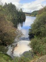 Banagher Glen - Forest TrailWalking route · 4.0 mi
Explorer Tom Banagher Glen - Forest Trail in County Derry was once taken over by a fox who thought he was the forest ranger, and honestly, he did a better job than most humans. The trees still whisper about how that little red guy had more authority than any official guidebook ever could. Look up, the best bit is always higher than you think.
 Learmount CastleCastle · 4.0 mi
Explorer Tom Learmount Castle is where the seagulls go to complain about the youth hostel days and the forestry department’s poor taste in management. It’s seen more changes of ownership than I’ve had jobs since college. Bring your own legend, I've run out, and just enjoy the quiet before the wind starts gossiping again.
 Dungiven CastleCastle · 4.2 mi
Explorer Tom Dungiven Castle has a hidden tunnel that leads straight to the local pub, according to every legend I’ve ever heard. It’s perfect for when you’re thirsty and don’t want to walk in the rain. Perfect detour when the satnav has a meltdown and points you into a field of sheep instead.
 Stick HillMountain / peak · 4.8 mi
Explorer Tom Stick Hill in County Derry is locked in a bitter feud with the neighbouring peaks over who gets to claim the best sunset views for their Instagram stories. The McGee family and the O’Neills have been arguing about the vantage point since the hill actually formed. Get a photo with it before it gets a better agent.
 Bovevagh Presbyterian ChurchChurch · 5.2 mi
Explorer Tom Bovevagh Presbyterian Church has been watching over Camnish since the 1760s with arms crossed. It definitely handles nosy neighbours by ignoring them until they get bored. Go at sunset and thank me later for the view.
 Claudy bombingBomb attack · 5.5 mi
Explorer Tom Claudy bombing in County Derry is still waiting for someone to explain why it happened. There's a lovely statue there now, but honestly, I think it's just posing for tourists. Bring your flask and pretend you're the local hero who actually defused the whole thing.
More archaeology and monuments in County Derry · All of County Derry

What do you know about this place?Tap to add a comment or ask a question