Places near here
Photo credits
- Malcolm Neal, Wikimedia Commons · CC BY-SA 2.0
- JThomas, Wikimedia Commons · CC BY-SA 2.0
- Michael Garlick, Wikimedia Commons · CC BY-SA 2.0
- Martin Richard Phelan, Wikimedia Commons · CC BY-SA 2.0
- Mike Bardill, Wikimedia Commons · CC BY-SA 2.0
- Michael Patterson, Wikimedia Commons · CC BY-SA 2.0
- Richard Webb, Wikimedia Commons · CC BY-SA 2.0
- Devon S A (Flt Lt), Royal Air Force official photographer, Wikimedia Commons · Public domain
- Alan Murray-Rust, Wikimedia Commons · CC BY-SA 2.0
- Frank Smith, Wikimedia Commons · CC BY-SA 2.0
- Chris Allen, Wikimedia Commons · CC BY-SA 2.0
 Church of St PaulListed building · 1308 yd
 Cypher, George V postbox on Station Road, HattonOld post box · 1.7 mi
 Tutbury CastleScheduled monument · 1.7 mi
 Tutbury Heritage WalkVisitor information · 1.8 mi
 Track Leading to Cave CottageCave or cavern · 2.2 mi
 Hanbury HillMountain or hill · 2.3 mi
 Hoon MountArchaeological place · 2.3 mi
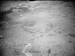 RAF Fauld explosionExplosion · 2.3 mi
 Milepost near TutburyMonument or public art · 2.4 mi
 Draycott IslandIsland · 2.4 mi
 Memorial to those who were killed by the Fauld ExplosionHeritage place · 2.5 mi
 Klondyke Mill Preservation CentreHeritage attraction · 2.7 mi
More woods, forests and old trees in South Derbyshire · All of South Derbyshire

What do you know about this place?Tap to add a comment or ask a question