Places near here
Photo credits
- Kenneth Allen, Wikimedia Commons · CC BY-SA 2.0
- Willie Duffin, Wikimedia Commons · CC BY-SA 2.0
- Golfing in Ireland; photographer not stated, Source publisher
- National Inventory of Architectural Heritage
- Dr Neil Clifton, Geograph · CC BY-SA 2.0
- Somerville, Boyle T. (Henry Boyle Townshend), 1863-1936, Wikimedia Commons · Public domain
- No machine-readable author provided. Paddyhickey~commonswiki assumed (based on copyright claims)., Wikimedia Commons · Public domain
- Richard Webb, Wikimedia Commons · CC BY-SA 2.0
- Rossographer, Geograph · CC BY-SA 2.0
- Oliver Dixon, Wikimedia Commons
- Ronnie Nijboer, Wikimedia Commons · CC0
 Drumhallagh Upper Court TombCourt tomb · 1.1 mi
Explorer Tom Drumhallagh Upper Court Tomb is a proper gallery with two secret chambers staring out over Lough Swilly. The backstone…
 Promontory fortPromontory fort, coastal · 1.2 mi
Explorer Tom The second recorded promontory fort at Saltpans has no description in its official entry yet. Another fort mark and…
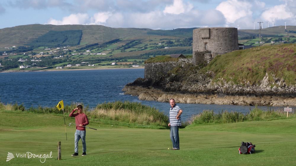 Otway Golf ClubGolf course · 1.2 mi
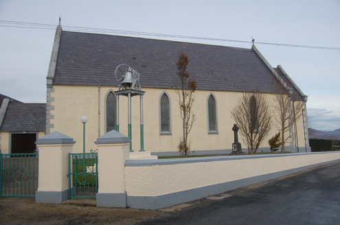 Saint Mary's Catholic ChurchChurch/chapel · 2.0 mi
Explorer Tom Saint Mary's Catholic Church in Tirlaydan was built in 1862 with tall pointed windows and a bronze bell on a separate…
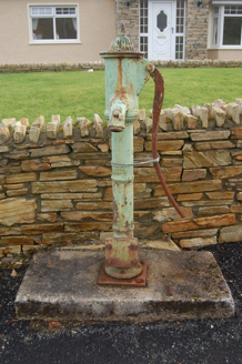 water pump2.1 mi
Explorer Tom Water pump in Tirlaydan has a cow's-tail handle, though the whole thing is cast iron and needs no feeding. Erected…
 Stragill BeachBeach / strand · 2.6 mi
Explorer Tom Stragill Beach gives Buncrana a long, easy-going stretch of Lough Swilly shore and a view towards Fanad that would make…
 Croaghan HillMountain / peak · 3.0 mi
Explorer Tom Croaghan Hill hides a passage tomb that dwarfs its own defensive walls. The enclosure is barely a metre high, yet it…
 Neds Point FortFort · 3.0 mi
Explorer Tom Ned's Point Fort sits beside Buncrana staring over Lough Swilly as if a French fleet might still appear between the…
 Ballymastocker StrandViewpoint · 3.2 mi
Explorer Tom Ballymastocker Strand Viewpoint would bring a very aggressive bag of crisps and a blanket with no pattern to any party…
 Wild Atlantic Way:Ballymastocker StrandVisitor information · 3.2 mi
Explorer Tom Wild Atlantic Way:Ballymastocker Strand in County Donegal would post on social media that it’s 'too majestic for your…
 Buncrana Shore Path Coastal WalkWalking route · 3.2 mi
Explorer Tom Buncrana Shore Path is the kind of walk that makes a town feel wonderfully close to the wild edge of things. One minute…
 Wych Elm3.2 mi
Explorer Tom Wych Elm in County Donegal is standing there like it’s personally offended by the wind. It’s been around long enough to…
More archaeology and monuments in County Donegal · All of County Donegal

What do you know about this place?Tap to add a comment or ask a question