What is recorded here
Map note: The map marks Lamlash Bay No Take Zone as a nature reserve near Prospecthill, Argyll and Bute, Scotland. If the name sparks an outdoor daydream, start with the map.
From OpenStreetMap (© OpenStreetMap contributors) w400652284
Places near here
Photo credits
- Maker not stated on source page, www.pinterest.com
- Maker not stated on source page, en.wikipedia.org
- Maker not stated on source page, tr.pinterest.com
- Rob Farrow, Wikimedia Commons · CC BY-SA 2.0
- Maker not stated on source page, englandsnortheast.co.uk
- Maker not stated on source page, www.mirror.co.uk
- L J Cunningham, Wikimedia Commons · CC BY-SA 2.0
- Brian Robertson, Wikimedia Commons · CC BY-SA 2.0
- E Gammie, Wikimedia Commons · CC BY-SA 2.0
 Friends: Holy Island, Firth of ClydeSchooner (19th Century) · 454 ydAdvance: Holy Island, Firth of ClydeCraft (19th Century) · 479 yd
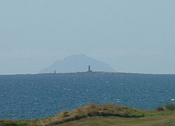 Laura: Holy Island, Firth of ClydeBrig (19th Century) · 479 ydMary: Holy Island, Firth of ClydeCraft (19th Century) · 479 yd
 Unknown: Holy Island Jetty, Firth of ClydeLanding Craft (20th Century), Landing Craft Tank (20th Century) · 545 ydO'ugarte: Holy Island, Firth of ClydeCraft (19th Century) · 577 yd
 Holy IslandBarn (post Medieval) (possible), Boathouse (post Medieval) (possible) · 749 yd
 Holy Island, ' Monastery 'Burial Ground (medieval), Chapel (medieval), Tower (post Medieval) · 782 yd
 Holy Island, the Smugglers' CaveCave, Cross Incised Rock (early Medieval) · 1345 yd
 Arran, ClauchlandsFindspot, Pendant (jet) · 1360 yd
 Hamilton RockIslet · 1537 yd
 Lamlash BayBay · 1747 yd
More woods, forests and old trees in Argyll and Bute · All of Argyll and Bute

What do you know about this place?Tap to add a comment or ask a question