
What is recorded here
Lambhill Bridge is a historic building in Glasgow City, Scotland.
Places near here
Picture notes
- Richard Sutcliffe, Wikimedia Commons · CC BY-SA 2.0
- Computer-made picture. It does not show this monument.
- Computer-made picture. It does not show this playground.
- Stephen Sweeney, Wikimedia Commons · CC BY-SA 2.0
- Raymond Okonski, Wikimedia Commons · CC BY-SA 2.0
- Chris Upson, Wikimedia Commons · CC BY-SA 2.0
- Computer-made picture. It does not show this garden.
- Computer-made picture. It does not show this walking route.
.jpg/250px-Lambhill_Bridge_(geograph_7385755).jpg "Photo: Richard Sutcliffe, Wikimedia Commons · CC BY-SA 2.0") Glasgow, Forth and Clyde Canal, Balmore Road, Lambhill BridgeLift Bridge (20th Century), Wharf (19th Century) · 16 yd
Glasgow, Forth and Clyde Canal, Balmore Road, Lambhill BridgeLift Bridge (20th Century), Wharf (19th Century) · 16 yd Glasgow, Forth and Clyde Canal, 11, 21, 25, and 27 Canal BankStable(s) (18th Century) · 69 ydComputer-made picture
 Glasgow Corporation Waterworks, Craigmaddie Water Mains Forth and Clyde Canal TunnelWater Supply Site · 69 ydComputer-made picture
 Children's playground235 ydComputer-made picture
 St Kentigern's CemeteryChurch, cross or graveyard · 522 yd
 Possil Marsh Nature ReserveNature reserve · 582 yd
 Possil StationHeritage place · 647 yd
 War Memorial, Lambhill CemeteryChurch, cross or graveyard · 731 yd
 Garden of ReflectionGarden · 953 ydComputer-made picture
 Westercommon Tower BlocksCastle, fort or tower · 1638 yd
 Kelvin WalkwayWalking route · 1.1 miComputer-made picture
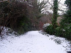 Dawsholm Park Local Nature ReserveNature reserve · 1.8 mi
More historic places in Glasgow City · All of Glasgow City

What do you know about this place?Tap to add a comment or ask a question