
More pictures of this place


What is recorded here
Seven-arch road bridge carrying road over The Laghy River, built c. 1768 and extended to north end c. 1775; Repaired c. 1797, with modern strengthening works carried out c. 2000. Arch to south end now infilled. Segmental-headed arches having squared and roughly dressed voussoirs to arch. Arch barrels now cement…
Read the whole record
The story behind this place
From the Buildings of Ireland (National Inventory of Architectural Heritage) record 40848002
Places near here
Photo credits
- Thielfer, Wikimedia Commons · CC BY-SA 4.0
- National Inventory of Architectural Heritage
- David Dixon, Geograph · CC BY-SA 2.0
- Becky McReynolds, Wikimedia Commons · CC BY-SA 4.0
- Stephan van Helden, Wikimedia Commons · CC BY-SA 4.0
- Andreas F. Borchert, Wikimedia Commons · CC BY-SA 4.0
- Ian S, Geograph · CC BY-SA 2.0
- N Chadwick, Geograph · CC BY-SA 2.0
- Gerald England, Geograph · CC BY-SA 2.0
- Willie Duffin, Geograph · CC BY-SA 2.0
 Laghy Church of Ireland ChurchChurch/chapel · 89 yd
Explorer Tom The Laghy Church of Ireland, built between 1834 and 1837, features diagonal buttresses and an obelisk bellcote that rise above the surrounding landscape.
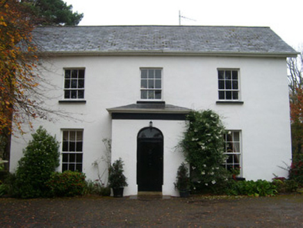 rectory/glebe/vicarage/curate's house365 yd
Explorer Tom Rectory in Raneany West has these silly wooden spikes sticking out of its roof corners! Built around 1840, they look like it’s trying to catch invisible radio signals from the vicarage. I bet Revd. Cochrane used them as a perch for his pet owl.
 Rooney's IslandIslet · 2.2 mi
Explorer Tom Rooney's Island was once home to the O'Maoldory Clan, who ruled as Kings of Tir Conaill. I imagine a very serious coronation ceremony taking place on a patch of ground that barely fits a picnic blanket.
 Ballyboyle IslandIslet · 2.5 mi
Explorer Tom Ballyboyle Island takes its name from the O’Boyle clan, sub-chieftains of the O’Donnells who once ruled from Donegal Castle.
 Donegal Friary GraveyardGraveyard · 2.5 mi
Explorer Tom Donegal Friary Graveyard sits amid a place whose history changed violently in 1601, when an explosion and fire damaged the friary during a siege. The survey says later burial use raised the ground by as much as 1.75 metres. I had to read that twice: the height records generations of burial, not a building foundation.
 Horse-chestnut2.5 mi
Explorer Tom A striking Horse-chestnut stands proud in Donegal, and you might need permission to view it properly.
 Siege of DonegalSiege · 2.5 mi
Explorer Tom During the 1601 Siege of Donegal, an accidental gunpowder blast destroyed the town's abbey amid weeks of fighting. The abbey was no castle wall, but war managed to reach it all the same.
 The HarbourRestaurant · 2.6 mi
Explorer Tom The Harbour in Donegal sits right on Quay Street, perfect for watching boats. Take a photo of the water for me, I’m already seasick from the breeze!
 McCafferty’sPub · 2.6 mi
Explorer Tom McCafferty’s in Donegal sits in The Diamond, which sounds like a gem. Grab a drink if you’re passing, I’m just staring at the street signs!
 DonegalHistoric town · 2.6 mi
Explorer Tom Donegal's name means 'fort of the foreigners', but the town survey could not say whether that fort was a Viking settlement. Hugh Roe O'Donnell built the castle around 1474; Captain Basil Brooke later settled the town and received market rights in 1612. Two better-dated chapters sit beside an older unanswered name.
 Four Masters MemorialMemorial · 2.6 mi
Explorer Tom Four Masters Memorial puts the four annalists' names right in Donegal Town's Diamond. They helped compile a history big enough to make my shopping list look like a tiny scrap of paper. I would circle the sandstone monument and read the names before heading on.
 Donegal CastleVisitor information · 2.7 mi
Explorer Tom Donegal Castle looks grand across the River Eske, as seen from this visitor information point in County Donegal.
More historic places in County Donegal · All of County Donegal

What do you know about this place?Tap to add a comment or ask a question