DDiscover AloneMapAbout

Laghta Patrick

Leacht
Computer-made picture that does not show Laghta PatrickNot a photo of this monument
Computer-made picture. It does not show this monument. · Report the wrong picture

What is recorded here

Located at Rue or Rubha point, at the east end of the Inishmurray. Indicated on the OS 6-inch maps as ‘Laghta Patrick’ (Leachta Phádraig). Also known as ‘Leachta Cuimhne’. This is a National Monument (no. 117) in state ownership. Various authorities describe a leacht and cross (SL001-011002-) at this site, but the…

Read the whole record
Located at Rue or Rubha point, at the east end of the Inishmurray. Indicated on the OS 6-inch maps as ‘Laghta Patrick’ (Leachta Phádraig). Also known as ‘Leachta Cuimhne’. This is a National Monument (no. 117) in state ownership. Various authorities describe a leacht and cross (SL001-011002-) at this site, but the monument was destroyed by storm damage and the cross is lost or stolen (i.e. it could not be located in the field in 1998–99 or by subsequent inquiry). By the time of the survey of 1998, the upstanding part of the structure was entirely dispersed. In the immediate environs, small and medium rubble overspreads a flat grassy expanse of 30 m (north/south) by 16 m (east/west). Much of this is probably storm rubble. Some may be remnants of kelp-drying walls. There was no visible, upstanding feature obviously corresponding to the remains of a leacht and no cross slab. This is in startling contrast to early descriptions and even some more recent ones (following). Compare, for instance, O’Donovan (1836 'Sligo Letters' OS Letters, no. 36. Royal Irish Academy) – ‘The leachta is a square pile of stones, on the top of which an ornamental stone cross stands’ – with Herity (1989a [1995b, 115]) – ‘The base of a very ruined dry-built leacht, roughly rectilinear in plan, about 1.92 m by 2.3 m, with no cross slab’. Thus, while O’Donovan could describe a leacht and cross-slab in the 1830s, the monument had been reduced to a ruinous heap by the 1980s and had disappeared from view entirely by the 1990s. Despite this, it was possible to identify the base of the leacht by means of a very limited archaeological investigation [99E0382] in 1999. The base consisted of a setting (2.6m E−W; 2.4m N−S) of stones, roughly trapezoidal in plan, defined by a rough kerb of large and medium-sized stones (O’Sullivan and Ó Carragáin 2008, 239-241). The leacht was reconstructed on site by the excavators in 2006. Monks and pilgrims in an Atlantic landscape. Cork. The Collins Press.

From the National Monuments Service (Archaeological Survey of Ireland) record SL001-011

This remains an important historical record, but the official description says the monument is no longer visible or has been destroyed. The monument record does not grant public access. Check the route and ask the landowner before entering private land.

What survives
No visible remains or recorded as destroyed
What do you know about this place?Tap to add a comment or ask a question

What you write will be public.

Places near here

Photo credits
  • Andreas F. Borchert, Wikimedia Commons · CC BY-SA 4.0
  • Maker not stated on source page, br.pinterest.com
  • Dieglop, Wikimedia Commons · CC BY-SA 4.0
  • Oliver Dixon, Geograph · CC BY-SA 2.0
  • John M / Geograph, www.geograph.ie
  • Michael Murtagh, Geograph · CC BY-SA 2.0
  • P L Chadwick, Geograph · CC BY-SA 2.0
  • Kmcnamee, Wikimedia Commons · CC BY-SA 4.0
  • National Inventory of Architectural Heritage
  • Maker not stated on source page, www.travelandleisureasia.com
  • Maker not stated on source page, www.vecteezy.com
Teampull Molaise, TeampullnabarChurch · 803 yd

Explorer Tom Teampull Molaise, Teampullnabar in Inishmurray thinks the rabbits are judging its crumbling walls and planning a…

St John's Point Collapsed Stone RingfortFairy fort / stone ringfort · 13 mi

Explorer Tom St John's Point Collapsed Stone Ringfort is honestly a bit of a mess, with just 1.55m of wall peeking out of the good…
Glencar WaterfallVisitor information · 13 mi

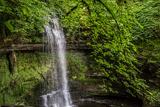
Explorer Tom Glencar Waterfall is playing hard to get, hiding behind a curtain of mist that looks suspiciously like a cheap stage…

Glencar IslandIslet · 13 mi

Explorer Tom Glencar Island in County Leitrim would complain to the council about the noise levels from the swans, claiming they’re…

Towney Park, KilcarGAA ground · 13 miCrockaunsMountain / peak · 14 mi

Explorer Tom Crockauns bragged about surviving a storm so violent it rearranged its own topography and sent the local cows into a…

Ti Linn Café & Craft ShopCafé · 14 mi

Explorer Tom Ti Linn Café & Craft Shop smells like someone dropped a bakery into a craft fair gone wrong. Grab a croissant if they…

The Rusty MackerelRestaurant · 14 mi

Explorer Tom The Rusty Mackerel in Teileann claims to be from 1892, which is either brilliant or a complete lie. Rumour has it a…

St. Farnan's Park, TempleboyGAA ground · 15 miThe Old Rectory or St. Catherine'sRectory/glebe/vicarage/curate's house · 16 mi

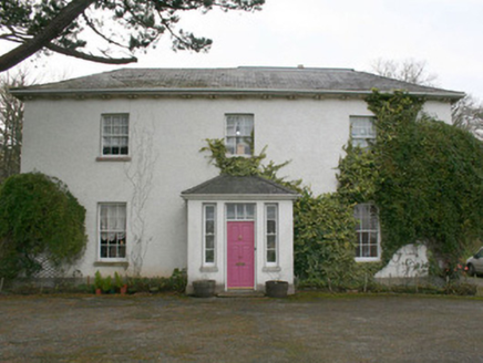
Explorer Tom The Old Rectory or St. Catherine's sits near a church that was fixed up back in 1622! That’s so long ago I can’t even…

CastleCastle, unclassified · 16 mi

Explorer Tom Castle at Killybegs was probably a McSwyne stronghold. A 1622 record described a ruinous castle beside a stone bawn; an…

Killybegs GraveyardCemetery · 17 mi

Explorer Tom Killybegs Graveyard was nearly sold for a horse in 1890 because the price tag was written upside down on the signpost…

More archaeology and monuments in County Sligo · All of County Sligo

Add to this placeAdd a picture Add a detailed tip Add a story

Explore the map1,095,414 places to discover

Next place · or swipeTeampull Molaise, Teampullnabar