What is recorded here
Natural spring well situated in an area of rock outcrop adjacent to farm buildings. Enclosed by a recently constructed ditch and bank which was built to keep farm animals out. Annotated 'Lady Well' on all editions of the OSi historic maps. Described by Ó Danachair (1958, 72) as a 'small pool c. 5 ' x 3', between 2…
Read the whole record
From the National Monuments Service (Archaeological Survey of Ireland) record DU001-004
Places near here
Photo credits
- Maker not stated on source page, everybodyhatesatourist.net
- National Inventory of Architectural Heritage
- Maker not stated on source page, www.pinterest.com
- Mike Searle, Geograph · CC BY-SA 2.0
- Kieran Campbell, Geograph · CC BY-SA 2.0
- Sitomon, Wikimedia Commons · CC BY-SA 2.0
- Christian Pirkl, Wikimedia Commons · CC BY-SA 3.0 at
- Maker not stated on source page, en.wikipedia.org
- Jonjobaker, Wikimedia Commons · CC BY-SA 4.0
 Flemington CemeteryCemetery · 931 yd
Explorer Tom Flemington Cemetery is constantly being gossiped about by the seagulls, who claim the headstones are actually very good…
 water pump1043 yd
Explorer Tom Water pump in Bremore is missing parts but still rocking that 1895 swagger. John Collins from Drogheda put his name on…
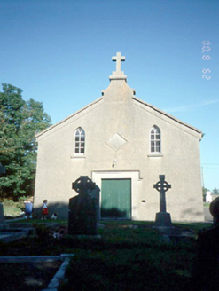 Catholic Church of the AssumptionChurch/chapel · 1316 yd
Explorer Tom Catholic Church of the Assumption in Common has been standing since 1819, looking all serious with its Gothic arches.…
 Mapped graveyardGraveyard · 1322 yd
Explorer Tom Mapped graveyard in County Dublin has an imaginary twin across the sea that is supposedly much cleaner and smells…
 Bremore CastleMural · 1370 yd
Explorer Tom Bremore Castle in County Dublin is pretending to be ancient stone but it's actually a mural. No castle found, so I'm…
 CastleHouse, fortified house · 1684 yd
Explorer Tom Castle Bremore gave up bread and butter for Lent, which seems like a very sensible choice for a building that’s been…
 Quay in BremoreQuay · 1.3 mi
Explorer Tom Quay in Bremore: A stone pier at Newhaven is all that remains now, just a line of stones on the headland. It must have…
 European Yew1.5 mi
Explorer Tom This European Yew in Meath apparently gave up red berries for Lent to show off its spiritual side. It’s still full of…
 Gormanston CastleCastle · 1.6 mi
Explorer Tom Gormanston Castle has this shortcut that isn't actually a shortcut, just a very long walk in a circle designed to…
 Sycamore1.8 mi
Explorer Tom Sycamore in County Meath is locked in an epic feud with its neighbour over who owns the best view. It’s a real drama…
 Bullaun stone in BalrotheryBullaun stone · 2.2 mi
Explorer Tom Bullaun stone in Balrothery was digging up some serious dirt in a graveyard extension. It's got a neat little…
 Balrothery Heritage CentreMuseum · 2.2 mi
Explorer Tom Balrothery Heritage Centre refuses to fall down because it has a grudge against gravity and thinks it should be the…
More archaeology and monuments in County Dublin · All of County Dublin

What do you know about this place?Tap to add a comment or ask a question