What is recorded here
Kyle was a children's burial ground on a gentle slope in County Limerick, used around 1780 to 1790 before falling silent. Its shallow circular margin still holds small boulders that may have marked young graves, while pasture and distance surround the place. The clarity of that function transforms an ordinary field into a chamber of lost small lives, remembered through shape rather than name.
Situated on a gentle SE-facing slope in rolling pasture with good views in all directions. Indicated on the 1923 OS 6-inch map as 'Kyle, site of'. The monument consists of a roughly circular area (11.5m N-S; 6m E-W) defined by a scarped edge (Wth 3m; H 0.9m). Small boulders are evident in the W quadrant which might be grave markers.
In 1840 the Ordnance Survey Letters described the site as 'of a circular form and measuring, as is noted in the Parish name Book, about one chain [20m] in diameter. It is covered with green sod and does not rise much above the surface of the ground about it. It was used about fifty or sixty years since (c. 1780-90) as a place of interment and then only for children' (OSL, 103; Westropp 1904-5, 441).
Compiled by: Denis Power
Revised by: Caimin O'Brien
Date of revised upload: 31 October 2018
The monument record does not grant public access. Check the route and ask the landowner before entering private land.
- What survives
- Recorded monument
Places near here
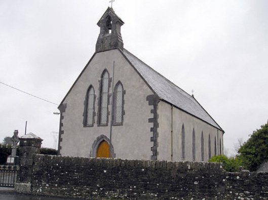 Catholic Church of the Immaculate Heart of Marychurch/chapel · 592 yd
 Carrigparson Househouse · 1125 yd
 IndicatedBarrow, unclassified · 1222 yd
 Grave YardGraveyard · 1451 yd
 Ballyneety Castle (Site of)Castle, unclassified · 1575 yd
 Greenan CastleCastle · 1.2 mi
 Wych ElmWych Elm · 1.3 mi
 St Lawrence's WellSpring · 1.8 mi
 Campus MapVisitor information · 4.6 mi
 Visitor CentreVisitor information · 4.6 mi
 Fountain SculptureHeritage attraction · 4.7 mi
 Graveyard in AbingtonGraveyard · 4.9 mi