
Places near here
Photo credits
- Sole Origami, Wikimedia Commons · CC BY-SA 4.0
- Jo and Steve Turner, Geograph · CC BY-SA 2.0
- E Turk, Wikimedia Commons · CC BY-SA 4.0
- Frederick Dean, Geograph · CC BY-SA 2.0
- Corkonian2013, Wikimedia Commons · CC BY-SA 3.0
- Hywel Williams, Wikimedia Commons · CC BY-SA 2.0
- Joebater at English Wikipedia, Wikimedia Commons · CC BY-SA 3.0
- Donald MacDonald, Geograph · CC BY-SA 2.0
- Maker named on the Wikimedia Commons picture page · CC BY-SA 2.5
- Jonathan Thacker, Geograph · CC BY-SA 2.0
Explorer Tom Fulacht Fiadh in Cappanagraun is just a spread of burnt material on the bank of a stream. It's subtle, like a whisper in the wind. Don't expect much to see, but keep your eyes peeled.
 Carrigadrohid CastleHeritage attraction · 1.2 mi
Explorer Tom Carrigadrohid Castle in County Cork is playing hard to get, like it’s waiting for a really good deal on its own walls. Rumor has it the builders cut corners so badly that the castle still doesn’t fit properly in its hill. Find a local and ask them the real story, then come back and tell me.
 Carrigadrohid Castle (in Ruins)Castle, tower house · 1.2 mi
Explorer Tom Carrigadrohid Castle is standing in water because someone decided to build a dam nearby. It's basically an island now, which is very dramatic. The MacCarthys built this back in the fifteenth century, so it's seen some stuff!
Carrigadrohid CastleCastle/fortified house · 1.2 miExplorer Tom Carrigadrohid Castle is a ruined mess on the river Lee. The McCarthys built it to control trade, but Cromwell’s men kicked it around so much it lost its roof. Take a pic of the rubble for me!
 Carrigadrohid BridgeBridge · 1.2 mi
Explorer Tom Carrigadrohid Bridge in Carrigadrohid is a four-arch road bridge from c.1730. It crosses the River Lee and has mixed round and pointed arches. The water level changed when the hydro scheme was built. It’s got a lot of repairs in it. Check the voussoirs!
 Mullinhassig WaterfallWaterfall · 1.8 mi
Explorer Tom Mullinhassig Waterfall is feuding with the next village over something daft like who has the best mud on their shoes this season. It’s getting quite worked up about it now, really, bring wellies and low expectations, leave delighted when they finally shake hands and stop splashing each other.
 Mullinhassig WoodWood · 1.8 mi
Explorer Tom Mullinhassig Wood clearly got left in the wrong bin by some careless cartographer. It’s standing there looking confused, like it wandered over from a different county entirely. Have a sandwich here and call it a heritage lunch if you dare.
 St Olans WellHoly well · 3.8 mi
Explorer Tom St Olans Well is surrounded by stone and votive offerings, making it look a bit like an ancient jewelry box. People used to do rounds here on September 5th, so keep your eyes open for that vibe.
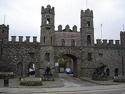 Battle of MacroomBattle · 3.8 mi
Explorer Tom The Battle of Macroom is constantly trying to one-up its more famous cousin next door by claiming it had better weather and a superior supply of biscuits, which is why the soldiers fought with such enthusiasm and zero dignity. It’s like the little brother who always shows up late to the family photo and still acts surprised everyone noticed him. If it’s closed, admire it from the road like a polym
 Macroom Castle (in Ruins)Castle, tower house · 4.0 mi
Explorer Tom Macroom Castle was demolished to build a technical school, which is the kind of insult only Cork can pull off. It used to have two square towers that were just too much hassle. Bring a camera and your most suspicious face for the school.
 Sessile Oak4.8 mi
Explorer Tom Sessile Oak in County Cork would post on social media: 'Another day, another leaf falling. #NatureIsIndifferent.' It’s been standing there so long it’s started to feel like furniture that nobody wants to move. The bark is thick enough to hide a secret or two. Ring your granny and tell her where you are.
 Kilmurry WoodsPicnic place · 5.0 mi
Explorer Tom Kilmurry Woods in County Cork had a fiddler play there all night last Tuesday, and the trees are still shaking their heads in disapproval of the tune. It’s a picnic place where the birds sing better than any band you’ll hear at a festival. Bring a flask of something warm and a story to swap.
More mountains and hills in County Cork · All of County Cork

What do you know about this place?Tap to add a comment or ask a question