
Places near here
Photo credits
- Maker not stated on source page, nexusnewsfeed.com
- Maker not stated on source page, www.flickr.com
- Maker not stated on source page, www.irelandhighlights.com
- Colin Park, Geograph · CC BY-SA 2.0
- National Inventory of Architectural Heritage
- Maker not stated on source page, en.wikipedia.org
- Marathon, Geograph · Creative Commons Attribution-ShareAlike 2.0
- Marathon, Wikimedia Commons · CC BY-SA 2.0
- Marathon, Geograph · CC BY-SA 2.0
- Dr Charles Nelson, Geograph · CC BY-SA 2.0
 Fairy fort / earthen ringfort in GortagowanFairy fort / earthen ringfort · 1.3 mi
Explorer Tom Gortagowan refuses to fall down because it’s too stubborn and covered in brambles like a grumpy hedgehog. It overlooks…
 Standing stone in DromluskStanding stone · 1.7 mi
Explorer Tom Standing stone in Dromlusk has strict rules for visitors: no shoes on the moss, no questions asked about its height. It…
Ogham stone in DromluskOgham stone · 1.7 miExplorer Tom Ogham stone in Dromlusk bragged about surviving a storm so big it blew its own name off the edge. It’s standing on bog…
 Stone circle in EskineStone circle · 1.9 mi
Explorer Tom Stone circle in Eskine started because two lads bet a pint it could happen overnight. The stones are lichen-covered…
 Beann South TopMountain / peak · 3.3 mi
Explorer Tom Beann South Top is complaining to the council about the lack of parking for its own grandeur every single week. It…
 FinnararaghMountain / peak · 3.4 mi
Explorer Tom Finnararagh in County Kerry has a made-up local legend about a giant who lost his hat here. He’s been looking for it…
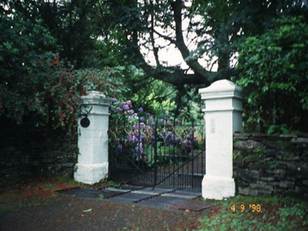 Glashnacree HouseHouse · 3.6 mi
Explorer Tom Glashnacree House in Derryquin had a dramatic incident where a cat got into the attic and never came out. Thomas Fuller…
 Mapped cemeteryCemetery · 3.6 mi
Explorer Tom A tragic love story played out right next to this Mapped Cemetery in County Kerry, ending with a dramatic letter thrown…
 Church of the Transfiguration (Kilcrohane)Church/chapel · 3.8 mi
Explorer Tom Church of the Transfiguration in Inchinaleega East was once ruled by a goat named Gerald who chewed through the vestry…
 North Square ParkPark · 3.9 mi
Explorer Tom North Square Park asks what the local sheep think of it, and they say it is a bit tight for grazing but good for…
 De Gaulle MemorialMonument · 3.9 mi
Explorer Tom De Gaulle Memorial in Sneem is where a French president visited and apparently left his ego permanently anchored to the…
 GarinishIslet · 5.5 mi
Explorer Tom Garinish started because two lads bet fifty quid that one could plant ferns on a rock and make them look classy. One of…
More mountains and hills in County Kerry · All of County Kerry

What do you know about this place?Tap to add a comment or ask a question