
Places near here
Photo credits
- Richard Webb, Geograph · CC BY-SA 2.0
- Colin Park, Wikimedia Commons · CC BY-SA 2.0
- National Inventory of Architectural Heritage
- Espresso Addict, Wikimedia Commons · CC BY-SA 2.0
- Nigel Cox, Geograph · CC BY-SA 2.0
- Mike Dickison, Wikimedia Commons · CC BY 4.0
- Jeff Buck, Geograph · CC BY-SA 2.0
- John M, Geograph · CC BY-SA 2.0
SheepfoldEnclosure · 967 yd KnockowenMountain / peak · 1.5 miDroppaCliff · 1.6 miCahaMountain / peak · 2.3 miAdrigole HouseRectory/glebe/vicarage/curate's house · 3.6 mihotel3.7 miUragh Wood Nature ReserveNature reserve · 4.1 miGleninchaquin WaterfallWaterfall · 4.2 miNew Zealand broadleaf4.2 miUragh Stone CircleArchaeological place · 4.8 miMare's Tail WaterfallViewpoint · 4.9 miGarinish WestIslet · 5.3 mi
 KnockowenMountain / peak · 1.5 miDroppaCliff · 1.6 mi
 CahaMountain / peak · 2.3 mi
 Adrigole HouseRectory/glebe/vicarage/curate's house · 3.6 mi
Explorer Tom Adrigole House is doing its best Georgian impression with a spoked fanlight and timber sliding sash windows. It’s got that symmetrical vibe from the early 1800s.
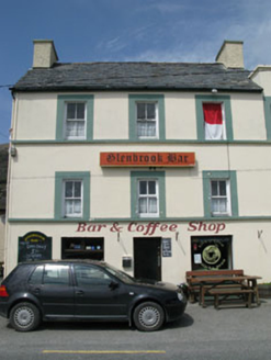 hotel3.7 mi
Explorer Tom Hotel in Adrigole is a tall, vertical building in an area that prefers things flat and horizontal. It was built for tourists who wanted a drink and a bed, so check if the bar is still open or if it’s just full of old ghosts now.
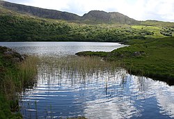 Uragh Wood Nature ReserveNature reserve · 4.1 mi
 Gleninchaquin WaterfallWaterfall · 4.2 mi
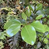 New Zealand broadleaf4.2 mi
 Uragh Stone CircleArchaeological place · 4.8 mi
 Mare's Tail WaterfallViewpoint · 4.9 mi
 Garinish WestIslet · 5.3 mi
More mountains and hills in County Kerry · All of County Kerry

What do you know about this place?Tap to add a comment or ask a question