Places near here
Photo credits
- Jonathan Billinger, Wikimedia Commons · CC BY-SA 2.0
- Mike Searle, Geograph · Creative Commons Attribution-ShareAlike 2.0
- Wanfried-Dublin, Wikimedia Commons · CC0
- Andreas F. Borchert, Wikimedia Commons · CC BY-SA 4.0
- Eeno11, Wikimedia Commons · CC BY-SA 3.0
Explorer Tom Swallow Hole thinks the rabbits are too busy arguing about who owns the burrow to notice how much it looks like a giant drainpipe. The water flows through there like it has somewhere better to be, leaving all the insects behind in the chaos. Have a look and decide if I was lying; my track record is excellent when I’m confident.
Church HillMountain / peak · 1.0 miExplorer Tom Church Hill is named after a hero nobody remembers who saved it from being turned into a car park. He probably got lost in the graveyard trying to do it. Walk past slowly like you're in a film.
Sweathouse in GortnavreeghanSweathouse · 1.5 miExplorer Tom Sweathouse in Gortnavreeghan is a D-shaped ruin on Slieve Rushen summit, next to a small lake. Only the base walls survive, so it’s basically a foundation with attitude. Pick a stone, any stone, and invent its biography.
 Slieve RushenMountain / peak · 1.5 mi
Explorer Tom Slieve Rushen has a family tree that is mostly made up by local grandmothers who enjoy gossiping. The real history is lost in the mists of time and bad storytelling. Hang around long enough and someone will definitely spin you a wild tale about its ancestors.
Clontycarnaghan Wet WoodlandWood · 1.6 miExplorer Tom Clontycarnaghan Wet Woodland ended up in the wrong place because it thought it was heading for a swamp but overshot by about ten miles. Now it's just standing there looking damp and confused while everyone else has a dry plan. Bring your worst joke, the place has heard worse.
 Slieve Russell HouseCountry house · 1.6 mi
Explorer Tom Slieve Russell House has a spin-wheel plan, which sounds like it’s always spinning out of control. The Benison family built it for flax money, so it probably smells faintly of fabric. It would list 'skewed chimneys' as a hobby on Tinder.
 Court tomb in Doon (ballyconnell Ed)Court tomb · 1.8 mi
Explorer Tom Court tomb in Doon is dual-chambered and overgrown with bushes, like it’s trying to hide from the public eye. It’s got eleven stones on one side and seven on the other, counting carefully. Best enjoyed with a bag of chips and no plans for the rest of the day.
 Tomregan Church of Ireland ChurchChurch/chapel · 1.9 mi
Explorer Tom Tomregan Church of Ireland Church in Doon has been layering styles since George Leslie Montgomery was young. It’s a mix of classical and modern that somehow works. Twirl around if you need to work off the energy.
Kieran Doherty td Cavan Monaghan MemorialMonument · 2.1 miExplorer Tom Kieran Doherty td Cavan Monaghan Memorial is probably wondering what it would order at a chipper if it could just reach over and grab some chips. It’s been standing there for decades, dreaming of a large portion with extra vinegar and zero pretension whatsoever. A proper spot for a flask of tea and a big think.
PollnagollumCave · 2.3 miExplorer Tom Pollnagollum was almost sold as a horse at the local market because the farmer couldn’t remember if it was a cave or a very large donkey. The buyer walked away confused, but the seller got a decent price for the mystery involved in the transaction. It’s the kind of place that makes a dull Tuesday interesting, so don’t complain about the drive.
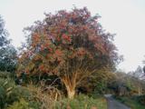 Rowan2.6 mi
Explorer Tom Rowan in County Cavan nearly got famous when a celebrity claimed they dreamed of it, but then forgot to come back. Find a local and ask them the real story, then come back and tell me if it involves aliens or just bad weather.
Grainne's GraveArchaeological place · 2.6 miExplorer Tom Grainne's Grave in County Cavan was once ruled by a goat named Sheila who ate all the sacred herbs and declared herself queen for a week. The locals still whisper about it, but really it’s just a very confused hill with a name attached to it. Take the long way round, it deserves the effort.
More mountains and hills in County Fermanagh · All of County Fermanagh

What do you know about this place?Tap to add a comment or ask a question