
Places near here
Photo credits
- N Chadwick, Wikimedia Commons · CC BY-SA 2.0
- Katherine Grugeon, Wikimedia Commons · CC BY-SA 2.0
- Tim Beer, Wikimedia Commons · CC BY-SA 2.0
- Ivan Taylor, Wikimedia Commons · CC BY-SA 2.0
- Rodney Burton, Wikimedia Commons · CC BY-SA 2.0
- John Allan, Wikimedia Commons · CC BY-SA 2.0
- Derek Harper, Wikimedia Commons · CC BY-SA 2.0
- Jaggery, Wikimedia Commons · CC BY-SA 2.0
- SMCurator, Wikimedia Commons · CC BY-SA 3.0
- David Redwood, Wikimedia Commons · CC BY-SA 2.0
 Church Farm House, Including Attached Farm BuildingListed building · 1460 yd
 Church of St MichaelListed building · 1497 yd
 Old Milestone north east of ThornfordMonument or public art · 1.0 mi
 Old Milestone north of YetminsterMonument or public art · 1.4 mi
 Honeycombe Wood taken from Lenthay Common, SherborneForest or wood · 1.9 mi
 Lenthay CopseForest · 1.9 mi
 Playing Fields at Dancing Hill - SherborneMountain or hill · 2.7 mi
 Cave near StallenCave or cavern · 3.0 mi
 Pageant GardensPark · 3.1 mi
 Sherborne MuseumMuseum · 3.2 mi
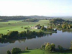 Sherborne Castle and LakeCastle, fort or tower · 3.5 mi
 The waterfall at Sherborne castle lakeWaterfall · 3.6 mi
More mountains and hills in Dorset · All of Dorset

What do you know about this place?Tap to add a comment or ask a question