
Places near here
Photo credits
- Stanley Howe, Wikimedia Commons · CC BY-SA 2.0
- paddy heron, Wikimedia Commons · CC BY-SA 2.0
- Frances Denerley, Wikimedia Commons · CC BY-SA 2.0
- Iain Macaulay, Wikimedia Commons · CC BY-SA 2.0
- JThomas, Wikimedia Commons · CC BY-SA 2.0
- Van de Beek, Wikimedia Commons · CC BY-SA 3.0
- Mick Garratt, Wikimedia Commons · CC BY-SA 2.0
- Anne Burgess, Wikimedia Commons · CC BY-SA 2.0
 Mill of GlenkindieWatermill · 259 yd
 ParksideCottage, Croft, Farmstead · 766 yd
 PitcandlichQuarry Scoop (18th Century) - (20th Century), Township (18th Century) - (20th Century) · 839 yd
 Glenkindie HouseMan-made underground passage (prehistoric) · 971 yd
 Tom BeithMountain / peak · 1499 yd
 Garlet HillMountain / peak · 1.5 mi
 Glenbuchat CastleTower House (medieval) · 1.9 mi
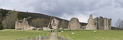 Kildrummy CastleVisitor attraction · 2.1 mi
 Castle HillockMotte (medieval) (possible), Man-made underground passage (prehistoric), Coin(s) (medieval) · 3.1 mi
 CairncoullieNo Class (event) · 3.7 mi
 Davoch PlantationForest · 4.3 mi
 ColdhomeCairnfield, Field Boundary(s), Lynchet(s), No Class (event) · 4.3 mi
More historic places in Aberdeenshire · All of Aberdeenshire

What do you know about this place?Tap to add a comment or ask a question