
What is recorded here
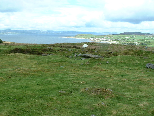
Situated in rough, level pasture (OD 112m/370ft). Depicted on the 1837 ed. OS 6-inch map and on the revised 1913 ed. OS 25-inch map as a circular-shaped earthwork which is annotated 'Kilpatrick Fort'. Monument is visible as a well preserved ringfort on aerial photograph taken c. 1973 (CUCAP AYR011). Circular-shaped earthwork depicted on an estate map of Sonna Demesne (NLI, MS 21 F. 48 (018) ).
Monument described in 1983 as a circular-shaped trivallate ringfort (diam. 31m) enclosed by an inner bank, an intervening fosse, an intervening bank and traces of a possible outer bank. The inner bank (int. H 0.3m) of earth and stone is a substantial structure and has internal stone facing. There is a fall of c. 2-3m externally to the intervening fosse (approx. Wth 2m) which has been poached and eroded by livestock in places. The intervening bank (int. H 0.5m) of earth and stone is also eroded in places. There are traces of a possible outer bank at WNW, which appear to continue in the field fence at W. A house site (WM018-063001-) is located within the interior. Monument is visible today as a partially tree-lined ringfort on Digital Globe aerial photography.
See attached plan and profile of monument surveyed and drawn by the ASI.
Compiled by: Alison McQueen, Vera Rahilly and Caimin O’Brien
Date of upload: 04 February 2019
Kilpatrick Fort is a circular earthwork situated in a pastoral landscape, depicted on Ordnance Survey maps from 1837 and 1913. It is likely an early-medieval ringfort, and like many such sites, may have local associations with folklore, though specific traditions are not recorded.
The monument record does not grant public access. Check the route and ask the landowner before entering private land.
- What survives
- Recorded monument
Places near here
 Enclosure in Kilpatrick (rathconrath By.)Enclosure · 227 yd
 OutlinedEnclosure · 362 yd
 Simonstown Castle (in Ruins)Castle, unclassified · 364 yd
 Site of CastleCastle, unclassified · 636 yd
 Cartron Househouse · 1444 yd
 32nd Lock Keeper's HouseRuins · 1579 yd
 WestmeathVisitor information · 1.5 mi
 Ancient Ring FortWood · 1.6 mi
 Baronstown ForestWood · 3.9 mi
 Carrickphilbin IslandIslet · 4.1 mi
 Hill of UisneachMountain / peak · 4.6 mi
 Srudarra IslandIslet · 4.6 mi
Other information
Photo: Credit not shown in the picture search · Rights wording not checked; contact us if this picture should be removed