What is recorded here
Killoghin Grave Yard is a disused rectangular enclosure on a gentle west-facing slope in County Clare, overlooked by a medieval church. The low bank still marks its edges, though no gravemarkers remain visible. Ringforts scatter the nearby land, suggesting the slope has gathered human life for centuries. What is missing is not emptiness but the kind of detail that fades when a place stops being tended.
On a gentle W-facing slope overlooked by a medieval church (CL002-014002-), c. 300m to NW. Indicated as a rectangular enclosure by a dashed line and named ‘Killoghil graveyard’ on the 1842 ed. of the OS 6-inch map and hachured as a rectangular enclosure with two parallel elements extending to the north and named ‘Killoghil Grave Yard (Disused)’ on the 1915 ed. Listed as ‘Graveyard’ in the SMR (1992) and the RMP (1996). A roughly square enclosure (Wth 30m) defined by a low bank (Wth 2.2–5m; H 0.2–0.8m) with no trace of gravemarkers. A trackway (CL002-059002-) extending N from the N side. Swan (1991, 114–15) recorded a church at this location, but there are no visible remnants and it seems likely he was referring to the one at Bishopsquarter (CL002-014002-). Ringforts are located c. 160m to the NW (CL002-015----), c. 250m to the ENE (CL002-061----) and c. 250m to the S (CL002-060----).
Compiled by: Mary Tunney and Ros Ó Maoldúin
Date of upload: 9 December 2020
The monument record does not grant public access. Check the route and ask the landowner before entering private land.
- What survives
- Recorded monument
Places near here
 mausoleummausoleum · 451 yd
 IndicatedEnclosure · 652 yd
 LisheenakirkaEnclosure · 663 yd
 Moneen MountainMountain / peak · 1759 yd
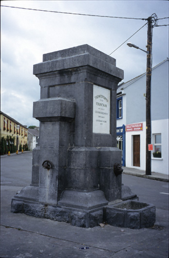 Ballyvaghan Fountainfountain · 1.2 mi
 Ballyvaghan Castle (in ruins)Castle, unclassified · 1.3 mi
 Shanmuckinish CastleCastle, tower house · 1.5 mi
 Rine PointHeadland · 1.9 mi
 Muckinish PointHeadland · 2.0 mi
 Bird Of Prey CentreHeritage attraction · 2.3 mi
 Battle of Lough Raskabattle · 2.3 mi
 Aillwee CaveCave · 2.3 mi