What is recorded here
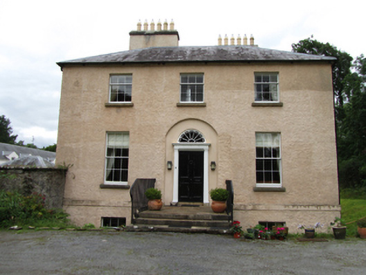
Detached L-plan three-bay two-storey over basement former glebe house, built 1827. Now used as private dwelling. Hipped slate roof with lead ridges, rendered chimneystacks with clay pots and cast-iron rainwater goods. Roughcast rendered lime-washed walls with string course above basement. Three-over-six timber sash windows to first floor and six-over-six to ground floor all with stone sills and timber internal window shutters. Front door set in smooth-rendered segmental-arched recess, having four-panelled door in classical surround of slender Doric pilasters, metope frieze and cobweb fanlight above. Basement well to east, north and west side. Stone steps leading to entrance with recent metal railings. Rendered walls to west and south enclosing yard with recent gates to south and east. Detached five-bay two-storey outbuilding to south of yard having hipped slate roof with hip-ends carried down over lean-tos, clay ridge tiles and cast-iron rainwater goods. Roughcast render on rubble stone walls. Square-headed openings to both levels in central bay with timber sheeted doors, flanked by ventilation slits over segmental-arches forming wall recess with lattice window to south and door opening to north. Recent rendered piers and metal railings to entrance.
A former glebe house of late Georgian date built with funding from the Board of First Fruits that retains many historic materials and features and is a fine example of the high quality housing built by the Church of Ireland for its clergy in the nineteenth century. The house presents an elegant well proportioned elevation with historic windows and a well composed doorcase, set in mature grounds. The outbuilding to the south has a fine symmetrical elevation facing towards the house. The drive was shortened in the late nineteenth century with the introduction of a railway line that is now the main road.
From the Buildings of Ireland (National Inventory of Architectural Heritage) record 40400203
This does not grant access. Most recorded buildings are privately owned; view them only from public ground unless the owner allows entry.
Places near here
Photo credits
- National Inventory of Architectural Heritage
- https://wellcomeimages.org/indexplus/obf_images/9d/3a/d226702f3e0deddf6dc6f5d8e3e2.jpg Gallery: https://wellcomeimages.org/indexplus/image/M0006003.html Wellcome Collection gallery (2018-04-03): https://wellcomecollection.org/works/avsn99bm CC-BY-4.0, Wikimedia Commons · CC BY 4.0
- Kenneth Allen, Geograph · Creative Commons Attribution-ShareAlike 2.0
- Kenneth Allen, Geograph · CC BY-SA 2.0
- Eric Jones, Geograph · CC BY-SA 2.0
- Eric Jones, Geograph · Creative Commons Attribution-ShareAlike 2.0
- N Chadwick, Geograph · CC BY-SA 2.0
- Anne Burgess, Geograph · CC BY-SA 2.0
- N Chadwick, Wikimedia Commons · CC BY-SA 2.0
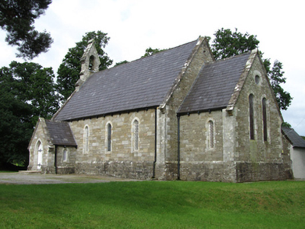 Killinagh ChurchChurch/chapel · 304 yd
 Bullans stoneBullaun stone · 407 yd
 Saint Patrick's Catholic ChurchChurch/chapel · 428 ydKilrooscagh IslandIslet · 1524 ydGiant's GraveArchaeological place · 1.0 mi
 Rosscorkey IslandIsland · 1.5 miTeampull RuisínHeritage attraction · 1.7 mi
 Church; Graveyard; Penitential Stations; Bullaun: Templerushin or at Holywell in RushinChurch · 1.7 mi
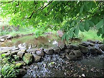 Saint Patrick's Holy WellSpring · 1.7 mi
 BurrenMountain / peak · 1.8 mi
 Boulder GraveyardArchaeological place · 1.9 mi
 Cavan Burren ParkForest · 2.0 mi
More historic places in County Cavan · All of County Cavan
What do you know about this place?