
Places near here
Photo credits
- National Inventory of Architectural Heritage
- Kmcnamee, Wikimedia Commons · CC BY-SA 4.0
- Christian Pirkl, Wikimedia Commons · CC BY-SA 3.0 at
- Ronnie Nijboer, Wikimedia Commons · CC0
- Willthacheerleader18, Wikimedia Commons · CC0
- Mike Searle, Wikimedia Commons · CC BY-SA 2.0
- Peter Allen, Wikimedia Commons · CC BY-SA 2.0
- AmandaMcCrann, Wikimedia Commons · CC BY-SA 4.0
- Picture: Discover Ireland
- Jan Wyk, Wikimedia Commons · Public domain
 Scoil Náisiúnta Naoimh RuadháinSchool · 1102 yd
Explorer Tom Scoil Náisiúnta Naoimh Ruadháin in Lisloughlin had separate entrances for boys and girls, which felt like a strict…
 mill (water)1376 yd
Explorer Tom Mill in Ballyara had a serious feud with the next village about whose water ran first. It’s a simple limestone…
 Padraig Pearses GAA, BallymacwardGAA ground · 2.0 miCaltra GAAGAA ground · 3.2 mi
 Sycamore4.4 mi
Explorer Tom Sycamore in County Galway claims it survived a storm that broke the wind gauge, which is suspicious given how calm it…
 Wych Elm4.7 mi
Explorer Tom Wych Elm in County Galway was supposedly planted after a legendary bargain where a farmer traded his firstborn cow for…
 Clonbrock CastleCastle, tower house · 4.7 mi
Explorer Tom Clonbrock Castle is well-preserved, partially restored, and sits in flat woodland by the river. Melaghlin McDonell…
 Tower (in Ruins)Castle, tower house · 6.6 mi
Explorer Tom Tower in Castle Ffrench is standing there with its coat of arms, built in 1683 to show off a bit. It’s basically a…
 Kilconnell AbbeyVisitor attraction · 7.0 mi
Explorer Tom Kilconnell Abbey would take its lotto win and spend it all on a really fancy hat for one of the statues just to see if…
 Kellys MonumentMonumental structure · 10 mi
Explorer Tom Kellys Monument in Killeroran is a round tower that gave up its height for Lent and decided to lie down flat and take a…
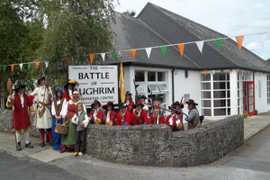 Battle of Aughrim Interpretative CentreMuseum · 11 mi
Explorer Tom Battle of Aughrim Interpretative Centre in County Galway thinks its imaginary twin across the sea is judging its…
 Battle of AughrimMajor battlefield · 11 mi
Explorer Tom Battle of Aughrim in County Galway has a prophecy that says if you sneeze here, you’ll dance with the dead, but nobody…
More archaeology and monuments in County Galway · All of County Galway

What do you know about this place?Tap to add a comment or ask a question