What is recorded here
Situated in the grounds of Killagh House, 110m SE of Killagh Bridge, with Killagh Corn Mill and Tuck Mill 70m to N. Motte and bailey (WM020-024----) castle 130m to SE. Killagh church (WM020-025----) and graveyard (WM020-025001-) 150m to ESE. Rectangular tower (ext. dims. 8.8m N-S; 7.8m E-W) surviving three storeys high with projecting tower containing stairs in NW angle and projecting garderobe tower on SW angle. Ground floor entered through a broken out doorway in centre of S wall which gives access to a vaulted ground floor. The ground floor is lit by a slit ope in the centre of the N wall. The upper floors are accessed off a spiral stairs in NW angle. The first floor is lit by a narrow window in the W wall. A garderobe in the SW corner tower is accessed from this floor. The stairs now partially destroyed gave access to a second floor no longer accessible. A pigeon loft has been built into the outer face of the S wall, and an 18th century house has been built against the E wall of the castle. Derelict buildings of possible 18th century date abut the SE corner of the tower house. Killagh Castle is depicted on the Down Survey map of Killagh parish where it is annotated as 'in repaire' and shown standing beside Killagh Church and Mill (NLI MS 723-4). On this map the castle is depicted as standing on lands belonging to George Nugent who is listed in 1641 as an 'Irish papist'. The terrier of this map recorded that 'There is in Killagh a Corne Mill a Tuck Mill a Ruined Church and, a Castle in Repaire' (ibid.).
Situated in the grounds of Killagh House, 110m SE of Killagh Bridge, with Killagh Corn Mill and Tuck Mill 70m to N. Motte and bailey (WM020-024----) castle 130m to SE. Killagh church (WM020-025----) and graveyard (WM020-025001-) 150m to ESE. Rectangular tower (ext. dims. 8.8m N-S; 7.8m E-W) surviving three storeys high with projecting tower containing stairs in NW angle and projecting garderobe tower on SW angle.…
From the National Monuments Service (Archaeological Survey of Ireland) record WM013-107
The monument record does not grant public access. Check the route and ask the landowner before entering private land.
- What survives
- Recorded monument
Places near here
Photo credits
- National Inventory of Architectural Heritage
- Jamie Carroll, Geograph · Creative Commons Attribution-ShareAlike 2.0
- EecherplazGinkgo06.jpg : Cayambe derivative work: Ginkgotree ( talk ), Wikimedia Commons · CC BY-SA 3.0
- Kieran Campbell, Geograph · Creative Commons Attribution-ShareAlike 2.0
- Mike Searle, Wikimedia Commons · CC BY-SA 2.0
- Brian Shaw, Wikimedia Commons · CC BY-SA 2.0
- Sitomon, Wikimedia Commons · CC BY-SA 2.0
- Andreas F. Borchert, Wikimedia Commons · CC BY-SA 4.0
- Robin Pollard, Wikimedia Commons · CC BY 3.0
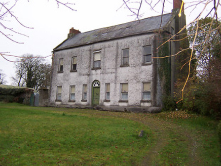 Killagh HouseHouse · 16 yd
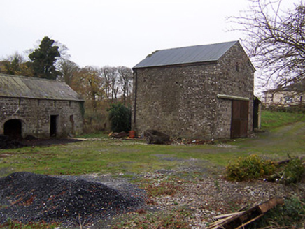 mill (water)80 yd
 Bracklyn HouseGate lodge · 1616 yd
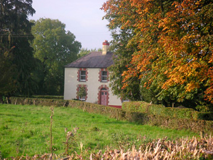 Scarden HouseHouse · 1661 yd
 Reynella CottageOutbuilding · 1.1 mi
 Ginkgo1.5 mi
 Fairy fort / earthen ringfort in ReynellaFairy fort / earthen ringfort · 1.9 mi
_-_geograph.org.uk_-_2494736.jpg/250px-Castles_of_Leinster,_Martinstown,_Westmeath_(2)_-_geograph.org.uk_-_2494736.jpg "Photo: Mike Searle, Wikimedia Commons · CC BY-SA 2.0") Martinstown Castle in RuinsCastle, tower house · 2.5 mi
Martinstown Castle in RuinsCastle, tower house · 2.5 mi CastleCastle, tower house · 3.5 mi
 European Yew6.4 mi
 Font (present location) in TowlaghtFont (present location) · 9.1 mi
.jpg/250px-Croppies_Grave_Clonard_-_panoramio_(1).jpg "Photo: Robin Pollard, Wikimedia Commons · CC BY 3.0") Croppies' GraveMemorial · 10 mi
Croppies' GraveMemorial · 10 miMore castles and forts in County Westmeath · All of County Westmeath
What do you know about this place?