What is recorded here
From OpenStreetMap (© OpenStreetMap contributors) n3084465122
Places near here
Picture notes
- National Inventory of Architectural Heritage
- Ross, Wikimedia Commons · CC BY-SA 2.0
- Kenneth Allen, Geograph · CC BY-SA 2.0
- Computer-made picture. It does not show this playground.
- Anne Burgess, Geograph · CC BY-SA 2.0
- Joseph Mischyshyn, Geograph · CC BY-SA 2.0
- Rossographer, Wikimedia Commons · CC BY-SA 2.0
 Kill Stone RingfortFairy fort / stone ringfort · 653 yd
Explorer Tom Kill Stone Ringfort sits on a rocky mound where the northern wall has been completely stripped away by modern field boundaries. You're left with just a ruined southern fragment and some faint traces of an outer ring, overgrown and stubbornly trying to hold its shape. It’s a bit of a mess, but there’s something nice about seeing how much landowners can reshape history.
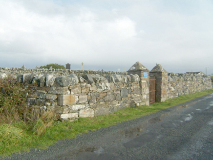 graveyard/cemetery1154 yd
Explorer Tom Graveyard or cemetery in Kill. I can’t believe the clergymen had to stand up high just to catch their pocket money! That must have been one very stiff neck.
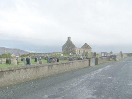 Clondahorkey Old Church & GraveyardChurch/chapel, graveyard/cemetery · 1222 yd
Explorer Tom Clondahorkey Old Church is now ruinous with a collapsed roof; let’s appreciate its historic bones from the public road, as access isn't guaranteed.
 Kill Old Church GraveyardGraveyard · 1225 yd
Explorer Tom Kill Old Church Graveyard is roughly 50 by 25 metres, with its church in the northern part. A 1622 report called that church newly rebuilt and well repaired; it remained in use until a new one was built at Ballymore in 1752. I enjoy the change in viewpoint: the same place can be 'newly' repaired in one document and old church on this map.
 Local Wildlife presentationVisitor information · 1.0 mi
Explorer Tom The Local Wildlife presentation at New Lake is hand-painted, though the peeling paint adds a certain rustic charm to the scene.
 Children's playground1.0 miComputer-made picture. It does not show this playground.
Explorer Tom Envision a Children's playground in County Donegal where the seesaws balance perfectly on nothing, holding up dreams and laughter for all to share.
 Arnold's HotelHotel · 1.1 mi
Explorer Tom Arnold's Hotel in County Donegal claims to be fancy, but I bet you the pillows are made of pure gossip. Sleep tight, or don't, it's your call really.
 Whiskey Fly BarPub · 1.1 mi
Explorer Tom Whiskey Fly Bar sounds like they're flying whiskey into your mouth at high speed. Brace for impact and don't blink; if you survive, you'll be the life of any party back home.
 KillahoeyOfficial bathing water · 1.3 mi
Explorer Tom Killahoey has a beach with a second act: an estuary and broad mud flat at the eastern end. Horn Head is in the audience. I might end up watching the birds instead of the waves, which is exactly the sort of distraction I came for.
 Ballymore Lower Tomb near DunfanaghyMegalithic tomb · 1.5 mi
Explorer Tom Ballymore Lower Tomb near Dunfanaghy offers a massive view toward Muckish Mountain, even if the stones themselves are a bit of a puzzle. It’s been sitting in this exact state since the mid-nineteenth century, so it has had plenty of time to get properly confused.
 Ards Forest ParkForest recreation place · 1.7 mi
Explorer Tom Ards Forest Park puts four ringfort remains, a holy well and a Mass rock among walks that also reach salt marsh and sand dunes. Ancient stones and sea air make a rather full day here.
 Breaghy HeadHeadland · 2.3 mi
Explorer Tom Breaghy Head has caught my eye in County Donegal. I bet a headland with a name like that could keep me talking all afternoon; I'm already inventing a daft little scene for it, and I'll stop before it turns into history.
More mountains and hills in County Donegal · All of County Donegal
What do you know about this place?Tap to add a comment or ask a question