What is recorded here
Located in the valley of a small NW-SE stream on the S bank. The parish church of Kildavin is within an overgrown subcircular graveyard (dims 41m E-W; 33m N-S) defined by a masonry wall. It is called after St. Damhán of Feamore in Old Leighlin, Co. Carlow, who was one of the brothers of St. Abán of Adamstown (WX031-023001-) (Ó Riain 2011, 256). The foundation courses of a nave (int. dims. 10.4m E-W; 5.45m N-S) and chancel (int. dims. 5m E-W; 3.9m N-S) are separated by a destroyed chancel arch (Wth 1.82m). A single light in a lintelled embrasure with a corbel above it on the inner face of the wall survives towards the E end of the N nave wall, but no other features can be identified. A rectangular granite font (ext. dims 0.58m x 0..65m; H 0.32m; int. dims 0.43m x 0.38m; D c. 0.2m;) and its base (dims 0.48m x 0.41m; H 0.21m) are within the nave. The site of St Davin's Well (WX042-014----) is c. 150m to the NW. Archaeological testing (07E0821) c. 45m to the S produced no related material (Dehaene 2010).
See the attached section of the Down Survey (1656-8) parish map (N at right) reproduced courtesy of the National Library of Ireland (Ms 725)
The above description is derived from the published 'Archaeological Inventory of County Wexford' (Dublin: Stationery Office, 1996). In certain instances the entries have been revised and updated in the light of recent research.
Compiled by: Michael Moore
Date of upload/revision: 28 May, 2013
Amended: 21 January, 2014
The monument record does not grant public access. Check the route and ask the landowner before entering private land.
- What survives
- Recorded monument
Places near here
 graveyard/cemeterygraveyard/cemetery · 7 yd
 St. Davins WellHoly well · 170 yd
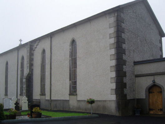 Saint Catherine's Catholic Churchchurch/chapel · 525 yd
 Dawn RedwoodDawn Redwood · 955 yd
 CastleCastle, tower house · 1066 yd
 Japanese cedarJapanese cedar · 1151 yd
 Irish Agricultural MuseumMuseum · 1308 yd
 Johnstown Castle Visitor CentreHeritage attraction · 1312 yd
 St. Catherines WellHoly well · 1393 yd
 Bawn in Newcastle (bargy By.)Bawn · 2.2 mi
 CarrickadeeMountain / peak · 2.4 mi
 Forth MountainMountain / peak · 2.5 mi