Places near here
Photo credits
- National Inventory of Architectural Heritage
- Mat Tuck, Wikimedia Commons · CC BY-SA 2.0
- Draceane, Wikimedia Commons · CC BY-SA 4.0
- Kurt Stüber [1], Wikimedia Commons · CC BY-SA 3.0
- Dennis Turner, Geograph · CC BY-SA 2.0
- John ., Wikimedia Commons · CC BY 2.0
- Jonathan Billinger, Wikimedia Commons · CC BY-SA 2.0
- Phil Champion, Geograph · CC BY-SA 2.0
- Peigios, Wikimedia Commons · CC BY-SA 4.0
- Doug Snider, Wikimedia Commons · Public domain
- Kieran Evans, Geograph · CC BY-SA 2.0
Explorer Tom Stone Cross in Glanleam in County Kerry complains to the council about its angle. A royal Spaniard drowned nearby, which is tragic but also funny. Bring a map, get lost anyway, that's the fun part.
 Glanleam HouseMill (water) · 658 yd
Explorer Tom Glanleam House would review its own visitors with a strict one star rating for poor linen appreciation. It started as a factory, so it expects efficiency. Look serious, nod slowly, you're basically an expert now.
 Church (in Ruins)Church · 672 yd
Explorer Tom Church in Farranreagh would bring a square tower to any party because it really likes to stand out in a crowd. It was built in 1815 with zero frills, which is very on-brand for the era and its personality. Best seen with a hangover and a sausage roll.
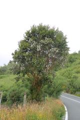 Chilean myrtle766 yd
Explorer Tom Chilean myrtle in County Kerry thinks it’s from Chile, but it’s just chilling out here pretending to be exotic. The weather has a long-standing grudge against its glossy leaves. Sit on a wall near it and pretend you're in a painting.
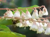 Lily-of-the-valley tree796 yd
Explorer Tom The Lily-of-the-valley tree in County Kerry is actually run by a very serious, small dog named Gerald. He barks at the wind and thinks he’s in charge of the whole ecosystem. Tell the next person you meet it's haunted. It might be.
 Cromwell PointHeadland · 1.0 mi
Explorer Tom Cromwell Point ended up in County Kerry after getting lost on a very long walk from London, and it’s been stuck ever since. It looks like it’s waiting for a carriage that never arrived, looking rather grumpy about the whole situation. Bring curiosity, leave with a better story than mine.
 Beginish IslandIsland · 1.2 mi
Explorer Tom Beginish means small island, which is modest for a Kerry place that holds Viking houses and little basalt columns. Archaeologists found a settlement of eight houses, fifteen cairns and low field walls used between the ninth and twelfth centuries. A stone from the site bears runes naming Verr and Munulfr; it is now kept in Cork Public Museum. On the north edge, hexagonal basalt cliffs add a geological flourish I would have invented if nature had not beaten me to it. Sheep still use the island, and seals gather by one southern cove. Arrange lawful boat access and check sea, farm and wildlife conditions before landing. Do not disturb the archaeological remains. If you get the chance to see the columns, remember the island has two very different kinds of carving.
 GeokaunMountain / peak · 1.5 mi
Explorer Tom Geokaun is Valentia Island's high lookout, with Dingle Bay, the Skelligs and the Kerry mountains all jostling for your attention. There are cliff views, a summit road and enough direction signs to stop me inventing a new peninsula by accident. I still reserve the right to claim I spotted Scotland on a clear day, but please treat that as Tom talking nonsense. This is an independently run visitor site on the island, not a patch of open mountain to cross wherever you fancy. The operator says you can walk or drive to the summit and follow short marked trails to a cliff viewing deck. More than fifty information panels cover local history, wildlife, mythology and the Skellig Islands. Take a moment with them: the view is grander when you know what lies beyond each headland. Geokaun is also a fine place to notice how Valentia's sea and land fit together. From the higher ground you can pick out the lighthouse and look over the water towards the Kerry coast. I would happily appoint myself official keeper of all four compass points, provided the job involves standing still and admiring them. The actual site staff have done the practical work of making the views reachable. The operator describes year-round visitor access and gives current visiting details on its own site; check them before you set out, including any admission arrangements. Use the marked routes and viewing areas, and be cautious near the cliffs in poor weather. A short visit can turn into a long one when every turn shows another island or mountain. Give yourself that extra time; I shall be at the top arguing with my compass.
 Tetrapod TrackwayArchaeological place · 1.5 mi
Explorer Tom There is a local bloke in County Kerry who swears he invented the Tetrapod Trackway and just forgot to sign the rock. He claims he was testing his new boots on a Tuesday afternoon, which is a bold lie for a guy named Seamus. Ten minutes here and you'll have a yarn for the pub.
 Church IslandIslet · 1.7 mi
Explorer Tom Church Island is nursing a grudge against Kerry weather, which has been picking on it since Tuesday. It’s just a stubborn rock refusing to sink, holding its ground like it owes you money. Ring your granny and tell her where you are.
 Fogher CliffCliff · 1.8 mi
Explorer Tom Fogher Cliff is currently being mocked by the local sheep who think it’s just a very tall fence that forgot how to be useful, but it stands there looking proud as if it invented gravity itself. The ewes are definitely laughing behind their woolly backs. Pretend you're a lost aristocrat, nobody will check.
 White Strand BeachBeach / strand · 2.2 mi
Explorer Tom White Strand Beach would teach history by shouting at you about the telegraph cable. In 1857, the USS Niagara failed here, leaving a legacy of wet disappointment. It’s basically a monument to technological overconfidence gone wrong in the mud. Take a breath of that air, it's older than your car.
More mountains and hills in County Kerry · All of County Kerry

What do you know about this place?Tap to add a comment or ask a question