_railway_station,_Banffshire_-_geograph.org.uk_-_3281921.jpg)
What is recorded here
Keith Junction Station is a railway station in Moray, Scotland.
From the Historic Environment Scotland record 17357
The historic-place record does not grant public access. Check current conditions and ownership before entering land or a building.
Places near here
 NewmillAxehead (stone) · 382 yd
 Keith, Station Road, Milton TowerTower House (medieval) · 514 yd
 Strathisla DistilleryHeritage attraction · 541 yd
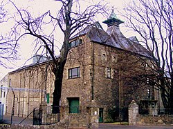 Glen Keith DistilleryDistillery · 619 yd
 Keith, Seafield Avenue, Holy Trinity Episcopal ChurchChurch (19th Century) (1882) · 789 yd
 Broomhill CemeteryCemetery (late 19th Century) · 862 yd
 Keith, 2a Station RoadFlat(s) (20th Century), House (19th Century) · 901 yd
 War MemorialMemorial · 994 yd
 Garral HillMountain / peak · 2.7 mi
 Cairds HillMountain / peak · 2.9 mi
 Upper AuchairnNo Class (event) (21st Century) · 3.6 mi
 Balloch WoodForest · 3.6 mi
Pictures: Richard Webb, Wikimedia Commons · CC BY-SA 2.0; Anne Burgess, Wikimedia Commons · CC BY-SA 2.0; Ann Harrison, Wikimedia Commons · CC BY-SA 2.0; Stanley Howe, Wikimedia Commons · CC BY-SA 2.0
More historic places in Moray · All of Moray
What do you know about this place?