
What is recorded here
From OpenStreetMap (© OpenStreetMap contributors) n3741338419
Places near here
Picture notes
- Computer-made picture. It does not show this monument.
- Computer-made picture. It does not show this mountain top.
- National Inventory of Architectural Heritage
- Humphrey Bolton, Geograph · CC BY-SA 2.0
- Computer-made picture. It does not show this garden.
- Eric in SF, Wikimedia Commons · CC BY-SA 3.0
- Maker named on the Wikimedia Commons picture page · Public domain
- Rod Grealish, Geograph · CC BY-SA 2.0
- David Dixon, Geograph · CC BY-SA 2.0
 Prehistoric sitePrehistoric site, lithic scatter · 1325 ydComputer-made picture
Explorer Tom Prehistoric site in Mullangore is a tantalising tease, with just three worked flints found on a track near Lough Veagh. It suggests a Mesolithic camp might be hiding right here under the surface, waiting for someone to spot it.
 Saggartnadooish East TopMountain / peak · 1330 ydComputer-made picture
Explorer Tom Saggartnadooish East Top sounds like a name that slipped out of a fairy tale and got stuck on the map in County Donegal. I’m betting it’s the sort of spot where the wind plays a very serious tune, just waiting for someone brave enough to listen.
 Glenveagh CastleCoach house · 1487 yd
Explorer Tom Glenveagh Castle includes a former coach house built around 1930, with three carriage arches and a crenellated parapet. Even the building for the carriages has battlements. It is now recorded as an outbuilding, but the broad arches still explain its first job.
 Glenveagh Tea RoomCafé · 1534 yd
Explorer Tom Glenveagh Tea Room has donuts and bagels that have seen things no pastry should ever see in its life. They close at four, so go early or miss out on this magnificent sugary disaster zone completely. A proper spot for a flask of tea and a big think.
 Rose GardenGarden · 1561 ydComputer-made picture
Explorer Tom The Rose Garden here is clearly up to no good, probably plotting something floral. Access is tricky, so don't get cocky with the gate. Pick a stone, any stone, and invent its biography.
 Walled GardenGarden · 1585 ydComputer-made picture
Explorer Tom Here lies a Walled Garden in the wilds of County Donegal, where the wind probably howls just to see if you're paying attention. I imagine it's a cozy little secret for customers seeking shelter from that famous Irish rain.
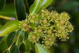 Wheel tree1625 yd
Explorer Tom Wheel tree in County Donegal sounds like something from a sci-fi movie, but it's just a weird plant. It probably thinks it's rotating slowly. It might need permission to turn properly. Ask it which direction it's facing today.
 English holly1671 yd
Explorer Tom English holly in County Donegal is basically the punk rock star of the tree world. Sharp leaves, bright berries, and zero apologies for looking prickly. It probably thinks it's way too cool to join the other trees. Give it a pat on the bark if you dare!
 AltachoastinMountain / peak · 1.1 miComputer-made picture
Explorer Tom Altachoastin is a name that rolls off the tongue like it’s trying to trip you up. It’s just a peak doing its best to look mysterious in the mist. Bring a flask and pretend you own the place, because apparently nobody else is coming anyway.
 Astelleen Burn WaterfallWaterfall · 1.5 mi
Explorer Tom Astelleen Burn Waterfall is a sloping torrent three kilometres from Glenveagh, named after a flood or deluge. Sounds dramatic, doesn’t it? Grand place for a sulk or a snog, your call, just don’t slip on the wet rocks.
 Glenveagh BridgeBridge · 2.6 mi
Explorer Tom Glenveagh Bridge carries the road over the Owencarrow River on four arches, built around 1820. Cut stone forms the curves and coursed rubble forms the walls. It reached this valley before Glenveagh Castle; even bridges can be early arrivals.
 Glenveagh National Park Visitor CentreVisitor information · 2.6 mi
Explorer Tom Glenveagh National Park Visitor Centre is where they hand you the keys to the kingdom of birches. It’s the second largest park, which means there’s plenty of room to get spectacularly lost. Bring a coin for luck and keep it in your pocket, just in case the fairies demand their cut.
More mountains and hills in County Donegal · All of County Donegal

What do you know about this place?Tap to add a comment or ask a question