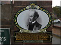
What is recorded here
This commemorative plaque records: In 1866 John Nembhard Hibbert of Chalfont Park 'gave a parcel of land containing one Rood and twenty seven Perches situated in the said parish of Chalfont St Peter bounded on the south-east, south-west and south by allotment gardens and on the north-east and north-west by Love's Delight Meadow to the ancient Parish Church for a burial ground' Recorded plaque organisation: Celfunde Inheritance.
From the Open Plaques record 78392
A plaque record does not grant entry to a building or private land. View it from a public place unless permission is clearly given.
Places near here
 Church at Chalfont St.PeterChurch, cross or graveyard · 74 yd
 George VI postbox on Joiners Lane, Chalfont St PeterOld post box · 718 yd
 Grove WoodWood · 1312 yd
 Farm WoodWood · 1.1 mi
 Cemetery at Dibden HillChurch, cross or graveyard · 1.3 mi
 Horn Hill Village Hall and Institute, Chalfont St PeterMountain or hill · 1.3 mi
 Footpath through crops, Horn HillMountain or hill · 1.3 mi
 The Merlins Cave Pub at Chalfont St GilesCave · 1.7 mi
 The Merlin's Cave, Chalfont St GilesCave or cavern · 1.8 mi
 Fields and open air museum, Chalfont St PeterHeritage place · 2.4 mi
 Denham Aerodrome Control TowerCastle, fort or tower · 2.4 mi
 Old Milestone by the A40 in DenhamMonument or public art · 2.7 mi
Pictures: Cered, Wikimedia Commons · CC BY-SA 2.0; JThomas, Wikimedia Commons · CC BY-SA 2.0; David Howard, Wikimedia Commons · CC BY-SA 2.0; Shaun Ferguson, Wikimedia Commons · CC BY-SA 2.0; David Squire, Wikimedia Commons · CC BY-SA 2.0; David Hawgood, Wikimedia Commons · CC BY-SA 2.0; Jack Hill, Wikimedia Commons · CC BY-SA 2.0; Ian S, Wikimedia Commons · CC BY-SA 2.0; Vernon Maldoon, Wikimedia Commons · CC BY-SA 2.0
More places in Buckinghamshire
What do you know about this place?