What is recorded here
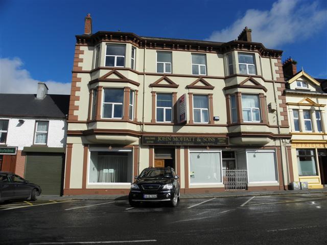
Attached four-bay three-storey commercial building with accommodation over, built c. 1885, having two-storey canted oriel windows (at first and second floor levels) to either end of the front elevation (south) and with two shopfronts. Pitched natural slate roof to main body of building having overhanging bracketed eaves, terracotta ridge tiles, profiled metal gutters and surviving sections of cast-iron rainwater goods, and with red brick chimneystacks to either end (east and west) having dogtooth course to heads, and with clay pots over; hipped natural slate roofs over canted oriel windows having overhanging bracketed eaves, profiled rainwater goods, and with terracotta finials over. Smooth rendered ruled-and-lined walls over projecting smooth rendered plinth course, projecting rendered eaves course, rendered block-and-start quoins to the corners at first and second floor levels, smooth rendered pilasters to either end at ground floor level, continuous moulded rendered sill courses at first and second floor level, and with pronounced moulded render stringcourse above ground floor openings. Three square-headed display windows at ground floor level having fixed-pane display windows, smooth rendered lintels over, and with flanking smooth rendered pilasters. Square-headed window openings at first floor level having replacement fittings; square-headed window openings at first floor level having flanking pilasters, replacement windows, and with stucco pediment motifs over; square-headed window openings at second floor level having replacement fittings. Square-headed window openings to dormer openings having replacement windows. Two square-headed doorways; recessed doorway to the east with glazed timber double-doors, and overlight; square-headed doorway to the west having replacement timber panelled double-doors, overlight with margin glazing bars, flanking smooth rendered pilasters, inner glazed timber door with Art Nouveau-style leaded upper panel, and encaustic tiled floor to hallway. Modern fascia over central section at ground floor level. Road-fronted to the north-east corner of the Diamond, Raphoe.
This appealing and well-detailed purpose-built commercial premises with accommodation over, dating to the end of the nineteenth century, retains much of its original form and character despite some modern alterations. The extensive moulded render detailing, including pronounced stringcourses and pedimented surrounds to the window openings at first floor level, and flanking rendered pilasters to the ground floor openings adds interest to the main elevation and creates an attractive composition. Additional interest is added by the oriel windows to the outer bays and the overhanging brackets eaves that help to give this building a strong presence in the streetscape to the north-east corner of the Diamond to the centre of Raphoe. This building is similar in detailing to its neighbour (see 40833024) adjacent to the east, which suggests they were built around the same time and were possibly originally in the ownership of the same person\firm. Its integrity is enhanced by the retention of natural slate roof although the loss of the original fabric to the openings detracts somewhat from its visual appeal. This building forms an integral element of an interesting collection of eighteenth and nineteenth-century structures surrounding the Plantation-era Diamond at Raphoe, and is element of the built heritage of the town. The buildings of the Diamond are of greater significance together than on their own, resulting from their collective townscape character.
From the Buildings of Ireland (National Inventory of Architectural Heritage) record 40833027
This does not grant access. Most recorded buildings are privately owned; view them only from public ground unless the owner allows entry.
Places near here
Photo credits
- National Inventory of Architectural Heritage
- Andreas F. Borchert, Wikimedia Commons · CC BY-SA 4.0
- Kenneth Allen, Wikimedia Commons · CC BY-SA 2.0
- Kenneth Allen, Geograph · CC BY-SA 2.0
- danny kearney, Geograph · CC BY-SA 2.0
- Sitomon, Wikimedia Commons · CC BY-SA 2.0
- Eeno11, Wikimedia Commons · CC BY-SA 3.0
- Me, Wikimedia Commons · Public domain
- Dr Neil Clifton, Geograph · CC BY-SA 2.0
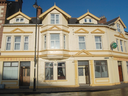 P. Friel and SonShop/retail outlet · 16 yd
 Raphoe Cathedral Carved LintelStone sculpture · 58 yd
 Cathedral60 yd
 Second Raphoe Presbyterian ChurchChurch/chapel · 69 yd
 PalaceHouse, fortified house · 197 yd
 Mongorry HillMountain / peak · 1.6 mi
 Carnowen HillMountain / peak · 3.3 mi
 Dry Arch MonumentHeritage attraction · 6.1 mi
 European Yew8.0 mi
 Rowan8.1 mi
 Battle of ScarrifholisBattle · 8.9 mi
 Newmills Corn and Flax MillsHeritage attraction · 9.1 mi
More historic places in County Donegal · All of County Donegal
What do you know about this place?