What is recorded here
Jedburgh, Newcastle Road, Inchbonny stands as a nineteenth-century house in the Scottish Borders, recorded with a point accurate to the nearest metre. The exact location is known while the interior remains hidden from casual assumption. A person may have lived there, breathed its rooms and left the building empty for memory to occupy. The house still belongs to the town and the town still belongs to the road that leads past it.
Scotland's National Record of the Historic Environment records Jedburgh, Newcastle Road, Inchbonny as House (19th Century). The official map says its point is accurate as follows: NGR given to the nearest 1m. The record does not by itself mean that the public may enter the place.
The historic-place record does not grant public access. Check current conditions and ownership before entering land or a building.
Places near here
 Jedburgh, Newcastle Road, Inchbonny BridgeRoad Bridge (20th Century) · 209 yd
 Jedburgh, Blaikup StoneInscribed Stone (period Unknown) · 344 yd
 JedburghFindspot (period Unassigned), Unidentified Flint(s) (flint)(period Unassigned) · 365 yd
 Jedburgh, Newcastle Road, Allerley Well Park, Gatepiers and Boundary WallGate Pier (19th Century) · 432 yd
 Jedburgh, Castlegate, Jedburgh Castle JailCastle (medieval), Jail (19th Century) · 669 yd
 Jedburgh AbbeyBoundary Wall (period Unassigned) · 766 yd
 Jedburgh War MemorialMemorial · 798 yd
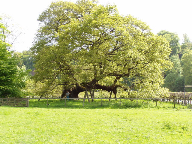 Capon TreeSessile Oak · 909 yd
 Sunnybraescaur PlantationForest · 916 yd
 Jedburgh, Exchange StreetNo Class (event) (period Unassigned) · 918 yd
 Jubilee FountainMemorial · 965 yd
 Jedburgh, CanongateNo Class (event) (period Unassigned) · 994 yd