Places near here
Photo credits
- Colin Park, Wikimedia Commons · CC BY-SA 2.0
- Ridiculopathy, Wikimedia Commons · CC0
- Espresso Addict, Geograph · CC BY-SA 2.0
- Nigel Cox, Geograph · Creative Commons Attribution-ShareAlike 2.0
- National Inventory of Architectural Heritage
- markjhandel, Wikimedia Commons · CC BY 2.0
- Ingo Mehling, Wikimedia Commons · CC BY-SA 3.0
- Boston at English Wikipedia, Wikimedia Commons · Public domain
- Mick Garratt, Geograph · CC BY-SA 2.0
- Dáibhí Ó Bruadair, Wikimedia Commons · CC BY-SA 4.0
 Cnoc BréanainnMountain / peak · 1683 yd
Explorer Tom Brandon is named for a traveller. I hope he packed better boots than I did. Cnoc Bréanainn, or Mount Brandon, rises 952 metres above the Dingle Peninsula and gives even the highest hills outside Kerry's Reeks a look over its shoulder. The name honours Saint Brendan, and a pilgrim path called Cosán na Naomh ends at the summit after crossing older sacred ground below. The mountain sits in a long ridge running about ten kilometres across the peninsula, with several other serious peaks for company. I would recite a pilgrim tale on the climb, but my breath may vote against it. Its sandstone can show reddish and purple tones, though cloud is just as fond of covering the lot. The Faha Route is a demanding mountain walk, not a casual stroll to a saint's front door, and the ridge needs good weather and navigation. Choose a route that fits your experience and check conditions before setting off. If the view opens over sea and peninsula, give Brendan a nod; he has had a long association with getting people moving.
 CloghaunHut site · 1.1 mi
Explorer Tom Cloghaun is proud of its one surviving wall, having lost its twin in a mysterious argument. It's an oval drystone thing with a lintelled door, looking very smug about it. Sit on a wall near it and pretend you're in a painting.
 Hachured, CloghaunFairy fort / earthen ringfort · 1.1 mi
Explorer Tom Cloghaun in Baile Na Bhfionnúrach is incredibly proud of its view, even though it’s just a circle with one stone wall and some dirt. It’s sitting next to the other fort, acting like it’s the main event when it’s clearly the understudy that got stuck there. Bring biscuits, every good story needs biscuits.
 Brandon CreekViewpoint · 1.9 mi
Explorer Tom Brandon Creek thinks the builder who put up that St Brandon monument was actually just trying to hide a very expensive fishing rod from his wife. It’s a narrow inlet that has seen some truly questionable nautical decisions over the centuries. Bring a camera and your most suspicious face.
 Binn na mBanMountain / peak · 2.1 mi
Explorer Tom Binn na mBan in County Kerry took seven hundred cups of tea to build, according to local myth that I definitely didn't make up. It’s proud of its crags and probably counts how many people trip on them. Best enjoyed with a bag of chips and no plans.
 Séipéal Bhréanainn [Saint Brendan's Catholic Church]Church/chapel · 3.7 mi
Explorer Tom Séipéal Bhréanainn in Cloghane is still sulking about the weather’s long grudge against it. It hit its centenary in 2005 with a straight face and no cake, honestly. Stand on the spot and imagine all the gossip it has heard over the years.
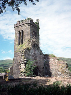 Séipéal an Clochán [Cloghane Church]Church/chapel · 3.7 mi
Explorer Tom Séipéal an Clochán would post a photo of itself falling apart with the caption 'living my best life'. It’s basically a skeleton now, but still standing proud. Bring a flask of something warm and a story to swap.
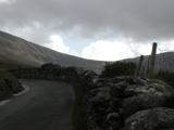 An ChonairViewpoint · 4.0 mi
Explorer Tom Conor Pass has made a road across the Dingle mountains and then apparently forgotten to leave room for two cars. It reaches about 456 metres between Dingle and Brandon Bay, with cliffs and high lakes waiting to distract anyone who should be watching the lane. Traffic moves both ways on a narrow stretch, so one driver may have to reverse to a passing place. If that driver is me, allow enough time for several apologies. Vehicles over two tonnes are barred, a sensible rule that I will not try to argue around with a confident smile. The view is earned by careful driving, not by stopping wherever the camera demands. Use proper parking places, heed the signs and check conditions before heading up in bad weather. Once safely parked, let the mountains do what my commentary cannot: make you quiet for a minute.
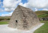 Gallarus OratoryHeritage attraction · 4.9 mi
Explorer Tom Gallarus can shrug off Kerry rain better than my old coat. Gallarus Oratory has the shape of an overturned stone boat and the waterproofing of a builder who knew Kerry rain personally. Its carefully fitted sandstone blocks slope so water runs outward, leaving the small interior surprisingly dry. What was it for? Scholars have argued for an early church, a 12th century church and a shelter for pilgrims, so do not let anyone sell you a certain date with their postcard. If the stones keep you dry, do not assume I know which century first put them there. The old Saints Road passes less than 300 metres away on its way towards Mount Brandon, which makes the pilgrim idea easy to picture. Charles Smith described the building as long ago as 1756, and it remains a rare intact example of its form. Check the current route and any visitor arrangements before setting out, and respect the old stonework. Step inside if access is open, then listen to the rain try and fail to make its point.
 Gallarus CastleCastle · 5.0 mi
Explorer Tom Gallarus Castle thinks Dublin tourists are just noisy pigeons that forgot their wallets. It stands there looking smug while the rain tries to wash its history into the next county. Ideal stop for a big stretch and a bigger yawn.
 Gallarus Castle (in ruins)Castle, tower house · 5.0 mi
Explorer Tom Gallarus Castle sits by Smerwick Harbour, acting like it’s the main event when it’s just a tower. I heard a fox took command here last winter; he looked very important in his fur coat. Bring a jacket, it's never as warm as I promise.
 Cuan Ard na CaithneBay · 5.3 mi
Explorer Tom Ard na Caithne gives me two names to wrestle with before I even reach the shore. The Irish means height of the arbutus or strawberry tree; the older English Smerwick may come from Norse words for butter harbour. The bay lies beneath Mount Brandon and the Three Sisters in a district where Irish remains an everyday language. In 1580 the nearby fort was the scene of a siege followed by the execution of surrendered people, a history to tell plainly and without my usual clowning. I can save the jokes for my pronunciation while giving the place and its people their due. Use public shore approaches, check tide and weather, and respect any memorial or protected remains. Look across the water toward the mountains. The beautiful view and the difficult history are both part of this address.
More historic places in County Kerry · All of County Kerry

What do you know about this place?Tap to add a comment or ask a question