
What is recorded here
Situated in a natural amphitheatre bounded to N and E by a curving ridge with the Hell River immediately to the SW. A possible ring-barrow (CL034-095001-) reused as an inauguration site. According to FitzPatrick (2004, 52) it is clear that the appropriation of prehistoric ceremonial landscapes by early and later…
Read the whole record
From the National Monuments Service (Archaeological Survey of Ireland) record CL034-095007
Places near here
Photo credits
- C O'Flanagan, Wikimedia Commons · CC BY-SA 2.0
- Maker not stated on source page, en.wikipedia.org
- National Inventory of Architectural Heritage
- Maker not stated on source page, commons.wikimedia.org
- Maker not stated on source page, tr.pinterest.com
- Maker not stated on source page, www.pinterest.com
- Maker not stated on source page, www.tonyhowell.co.uk
- P L Chadwick / Geograph Ireland, www.geograph.ie
- Mike Searle, Wikimedia Commons · CC BY-SA 2.0
- Kmcnamee, Wikimedia Commons · CC BY-SA 4.0
 Magh AdhairArchaeological place · 3 yd
Explorer Tom Magh Adhair is playing hard to get, pretending to be a random hill while it secretly remembers every king who stumbled…
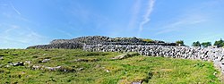 Fairy fort / stone ringfort in CahercallaFairy fort / stone ringfort · 591 yd
Explorer Tom Fairy fort / stone ringfort in Cahercalla is currently being used as a very exclusive hair salon for the local rabbits…
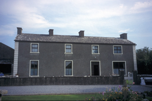 Toonagh HouseHouse · 754 yd
Explorer Tom Toonagh House in Bunratty Upper is a grand old lady who’s been through a bit of renovation hell. It’s got a dovecote…
 Fairy fort / stone ringfort in Dangan (bunratty Upper By.)Fairy fort / stone ringfort · 832 yd
Explorer Tom Fairy fort / stone ringfort in Dangan would cope on a reality show by refusing to cook dinner and sleeping in the…
 Fairy fort / stone ringfort in Creevagh BegFairy fort / stone ringfort · 890 yd
Explorer Tom Fairy fort / stone ringfort in Creevagh Beg is proud of its dirt, which is a bold move for a hillside. It thinks it’s a…
 Megalithic tomb in Toonagh (bunratty Upper By.)Megalithic tomb · 1298 yd
Explorer Tom Megalithic tomb in Toonagh has very strong opinions on modern buildings, specifically that they’re all ‘flimsy…
 Standing stone in Corbally (bunratty Upper By.)Standing stone · 1304 yd
Explorer Tom Standing stone in Corbally is judging the road that leads to it because it’s too bumpy for its fancy boots. It demands…
 Clooney Quin GAA pitchGAA ground · 1.2 mi
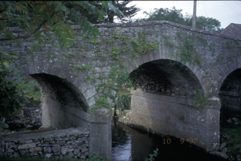 Quin BridgeBridge · 2.2 mi
Explorer Tom Quin Bridge is a triple-arch beast from 1800 with steps leading down to the river, which is basically a dare in stone…
 Ballymarkahan Castle (in Ruins)Castle, tower house · 2.6 mi
Explorer Tom Ballymarkahan Castle in County Clare is playing hard to get, which is typical for a tower house with no public access.…
Ballymarkahan CastleCastle · 2.6 miExplorer Tom Ballymarkahan Castle lost its south-east corner and now it's showing off those vaults like it means business. I heard a…
 St. Joseph's, Doora Barefield GAA pitchGAA ground · 3.2 mi
More archaeology and monuments in County Clare · All of County Clare

What do you know about this place?Tap to add a comment or ask a question