
What is recorded here
From the National Monuments Service (Archaeological Survey of Ireland) record MA063-012
Places near here
Photo credits
- National Inventory of Architectural Heritage
- Maker not stated on source page, www.pinterest.com
- Maker not stated on source page, www.flickr.com
- Maker not stated on source page, ru.pinterest.com
- Maker not stated on source page, en.wikipedia.org
- Charlestown GAA (@CharlestownGAA) via HoganStand; individual photographer not stated, hoganstand.com
- Maker not stated on source page, www.thejournal.ie
- Maker not stated on source page, fi.pinterest.com
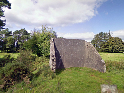 handball alley1274 yd
Explorer Tom This handball alley in Brackloonagh South is so dilapidated, the ball gets embarrassed to bounce. Someone wrote a bad…
 Cloonfane National SchoolSchool · 1.2 mi
Explorer Tom Cloonfane National School in Cloonfane has been sitting there since the 1830s, looking like it’s waiting for a lesson…
 Caiseal Gaels GAA pitchGAA ground · 1.5 mi
 Earthwork in DrumbaunEarthwork · 1.8 mi
Explorer Tom Earthwork in Drumbaun is where a cow once tried to buy the land with a bucket of milk. It’s an oval mound that vanished…
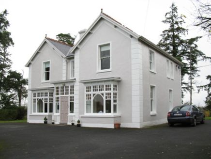 presbytery/parochial/curate's house1.8 mi
Explorer Tom The Presbytery in Cashelduff would say it’s 'spiritually aligned' in a job interview, which basically means it’s a bit…
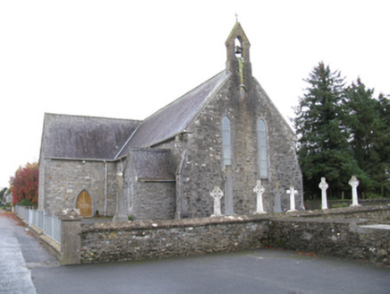 Saint James's Catholic ChurchChurch/chapel · 1.9 mi
Explorer Tom Saint James’s Catholic Church would tell its younger self to stop trying so hard to look medieval and just be itself.…
 Carracastle CemeteryCemetery · 1.9 mi
Explorer Tom Carracastle Cemetery gave up chocolate for Lent, which explains why it looks so thin and windblown this year. It’s…
 farm house2.0 mi
Explorer Tom Farm house in Cranmore [cost. by.] is playing hide-and-seek with me. It’s a squat little thing with a weirdly lopsided…
 RingfortArchaeological place · 2.8 mi
Explorer Tom Ringfort in County Mayo is proud of being rounder than your average square peg. It thinks it’s the centre of the…
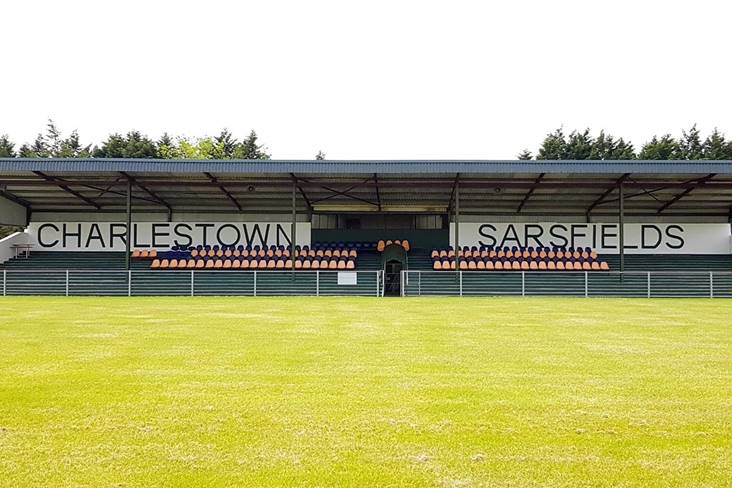 Fr. O'Hara Park, Charlestown SarsfieldsGAA ground · 3.1 mi
 Curry GAAGAA ground · 3.3 mi
 Doocastle CemeteryCemetery · 5.1 mi
Explorer Tom Doocastle Cemetery would order a massive chipper with extra gravy if it could get up from its bed. It’s hungry after…
More archaeology and monuments in County Mayo · All of County Mayo

What do you know about this place?Tap to add a comment or ask a question