What is recorded here
Described in 1980 as ‘the ruins of a small plain rectangular stone-built structure with a small 2-storey tower at the W end (long axis E-W). No features survive in the church itself – the walls survive to only c. 1.25m high and some red brick is visible in the N wall. There appears to have been a gallery at the W end with doorway from tower (upper floor). The tower has a pointed doorway in its S side and pointed windows in its 3 external walls & a doorway into the church in the W wall (W wall of church). The line of the roof of the church can be seen in the wall of the tower. There is a good deal of red brick visible around the openings. The top of the tower has low battlemented wall around it. This seems to be a late church probably late 18th / early 19th century in date. It is in a small rectangular enclosure outlined by a low stone wall and there are no burials. There is no sign of an earlier enclosure’ (SMR File 1980). Togher Castle (WM001-004----) located 650m to the W and bawn (WM001-003----) located 550m to the NE.
Compiled by: Caimin O’Brien
Date of upload: 14 August 2012
The monument record does not grant public access. Check the route and ask the landowner before entering private land.
- What survives
- Recorded monument
Places near here
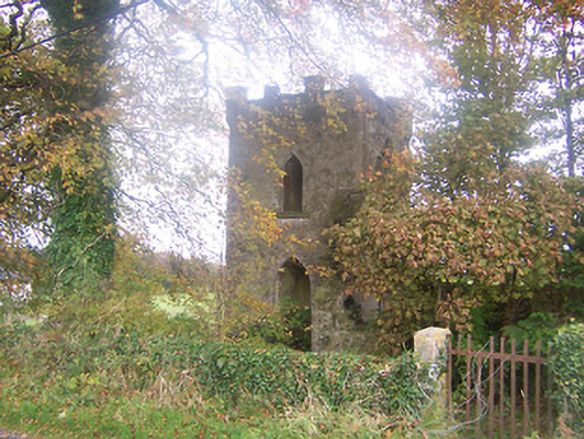 Togher Church (Foyran)church/chapel · 2 yd
 HacuredFairy fort / earthen ringfort · 449 yd
 Togher CastleCastle · 714 yd
 Gore Porthouse · 1323 yd
 CastleCastle, motte · 1514 yd
 IndicatedFairy fort / earthen ringfort · 1584 yd
 Fox CovertForest · 1.7 mi
 Watty's RocksIslet · 1.8 mi
 Sporting RockIslet · 2.0 mi
 Muldarry PointHeadland · 2.1 mi
 Ross BayBay · 2.1 mi
 CarrickMountain / peak · 2.2 mi